|
|
|
|
|
| Report Home | Maps | Overview | Mapping Methods | Coastal Classifications | Geologic Setting | Coastal Processes | Coastal Vulnerability | Classification Summary | References | |||||||||||||||||||||||||||||||
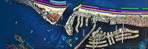
Coastal ProcessesThe Central Texas coast bordering the Gulf of Mexico is a low-energy, low-tidal range region that is constantly changing as a result of active coastal processes that are directly linked to meteorological events. Wind-driven waves and tidal currents are the most important geological agents controlling sediment transport and evolution of the Gulf and bay shores. Wind directions and intensities vary seasonally with southeasterly and southwesterly winds prevailing most of the year. Exceptions occur frequently during the winter months when wind-circulation patterns and low barometric pressure preceding the passage of cold fronts cause strong onshore winds and high waves that erode the beach. After the frontal systems pass the coast, winds shift to blow from the northwest or northeast, causing erosion along the lagoon sides of some barriers. Astronomical tides in the Gulf of Mexico are mixed and typically have a range of less than 1 m. Water levels vary only about 0.5 m between high and low tide during a normal tidal cycle. Tide records around the Gulf since the turn of the century all show the same general variations in sea level that coincide with droughts and periods of abnormally high rainfall. However, the tide records at Sabine Pass, Galveston, and Freeport show a relative rise in sea level that is caused by land surface subsidence and the global rise in sea level. Non-storm waves in the western Gulf of Mexico are normally less than 0.3 m high, and wave energy increases slightly to the south where deep water is closer to the shore. The largest waves and highest sustained wind speeds in the Gulf accompany major hurricanes. They also are responsible for the most storm-related property damage and loss of lives. Hurricanes entering or originating in the Gulf normally follow a northward or westward path. Using historical patterns of hurricane landfall, the National Hurricane Center has shown that the areas at greatest risk are around Galveston, Texas, southeastern Louisiana, and the Mississippi/Alabama coast (Simpson and Lawrence, 1971). Before crossing the Gulf Coast, the counterclockwise circulation of hurricane winds drives nearshore currents and large volumes of beach sand alongshore. The high tides, large waves, and strong currents that accompany the storms can leave permanent marks on the barrier islands and beaches. For example, some islands are breached during extreme storms and new inlets are formed. Even relatively weak storms have destroyed piers, seawalls, dune walkovers, swimming pools, roads, houses, and other buildings because structures were located close to the water and the beach did not recover from storm erosion before the next storm arrived. Fortunately, most of the buildings on Mustang and North Padre Islands are built landward of the high dunes that provide ample natural protection from storm waves. |
| AccessibilityFOIAPrivacyPolicies and Notices | |
 |
|