|
|
|
|
|
| Report Home | Maps | Overview | Mapping Methods | Coastal Classifications | Geologic Setting | Coastal Processes | Coastal Vulnerability | Classification Summary | References | |||||||||||||||||||||||||||||||
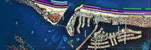
Geologic SettingThe Central Texas coast between Aransas Pass and Mansfield Channel consists of long, sandy barrier islands (Mustang and Padre Islands) that are wide and mostly undeveloped. The barrier islands formed several thousand years ago as sea level rose, and they have continued to enlarge as a result of abundant sand supplied by the longshore currents in the Gulf of Mexico (Morton, 1994). The barriers are characterized by wide beaches and relatively high continuous dunes that are densely vegetated except north of Mansfield Channel. In some areas, such as the northern part of Padre Island National Seashore, sand dunes have migrated across the barrier and into adjacent Laguna Madre during droughts. Because the tide range in the western Gulf of Mexico is so low and sand supply in the littoral system is so high, there are only two natural tidal inlet positions (Aransas Pass and Packery Channel) along the Central Texas coast. Packery Channel was a natural tidal inlet before it closed in 1930 as a result of deepening Aransas Pass so that ships could navigate safely to ports at Ingleside and Corpus Christi. Recently (2004), Packery Channel was artificially reopened to provide small boats shorter access from North Padre Island to the Gulf of Mexico. Several attempts were made to open an artificial channel (Yarborough Pass) on central Padre Island in the 1940s and early 1950s. All of these attempts failed because the channel shoaled rapidly and closed. The Fish Pass at Mustang Island State Park is an artificial channel that was dredged in 1972. The channel, which was intended to assist fish migration and to maintain water quality in Laguna Madre, began to shoal almost immediately and by the mid-1980s it was completely closed to normal tidal flow. Mansfield Channel was artificially dredged across Padre Island and jetties were constructed in 1957 to provide a stable navigation channel to Port Mansfield on the mainland. Beaches of the Central Texas coast change orientation from NE-SW to more N-S following an arc that is concave toward the Gulf of Mexico. The beach, which is composed of fine sand, typically contains some broken shells except near 27° north latitude (Padre Island National Seashore) where shells are so abundant the area is known as Big Shell Beach. Shells are concentrated along this beach segment because (1) it is within the zone of convergence of longshore currents that at different times flow from the northeast and the south, and (2) eolian processes (wind) remove sand from the beach and leave the shell as a lag deposit. |
| AccessibilityFOIAPrivacyPolicies and Notices | |
 |
|