U.S. Geological Survey Open-File Report 2009–1231
Integrated Multibeam and LIDAR Bathymetry Data Offshore of New London and Niantic, Connecticut
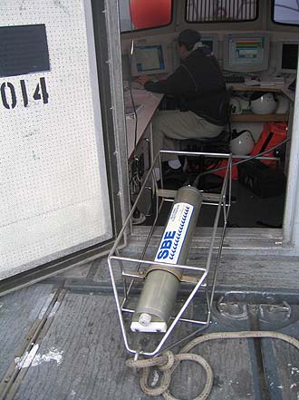 |
Figure 8. CTD (conductivity-temperature-depth) profiler. Data derived from frequent deployments of this device were used to perform sound-velocity corrections on the multibeam data. |

![]() U.S. Department of the Interior |
U.S. Geological Survey
U.S. Department of the Interior |
U.S. Geological Survey
URL: https://pubsdata.usgs.gov/pubs/of/2009/1231/html/fig8.html
Page Contact Information: Contact USGS
Page Last Modified: Wednesday, 07-Dec-2016 22:25:04 EST


