U.S. Geological Survey Open-File Report 2010–1007
Sea-Floor Geology and Character Offshore of Rocky Point, New York
 |
||
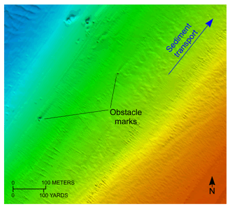
Figure 20. Detailed planar view of obstacle marks from the digital terrain model produced during National Oceanic and Atmospheric Administration survey H11251 off Rocky Point, New York. Asymmetry in the scour indicated net sediment transport at this location is toward the northeast. Location of view is shown in figure 16. | ||

![]() U.S. Department of the Interior |
U.S. Geological Survey
U.S. Department of the Interior |
U.S. Geological Survey
URL: https://pubsdata.usgs.gov/pubs/of/2010/1007/html/fig20.html
Page Contact Information: Contact USGS
Page Last Modified: Wednesday, 07-Dec-2016 22:38:11 EST


