U.S. Geological Survey Open-File Report 2010–1007
Sea-Floor Geology and Character Offshore of Rocky Point, New York
 |
||
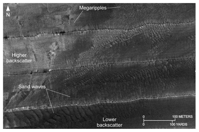
Figure 26. Detailed planar view of relatively straight to sinuous alternating bands of high and low backscatter from the sidescan-sonar mosaic produced during National Oceanic and Atmospheric Administration survey H11251 off Rocky Point, New York. Tiger-stripe pattern is indicative of transverse sand waves and megaripples. Location of view, which is northeast of Orient Shoal, is shown in figure 16. | ||

![]() U.S. Department of the Interior |
U.S. Geological Survey
U.S. Department of the Interior |
U.S. Geological Survey
URL: https://pubsdata.usgs.gov/pubs/of/2010/1007/html/fig26.html
Page Contact Information: Contact USGS
Page Last Modified: Wednesday, 07-Dec-2016 22:38:14 EST


