Skip past header information
USGS - science for a changing world

U.S. Geological Survey Open-File Report 2010-1091

High-Resolution Geophysical Data Collected Within Red Brook Harbor, Buzzards Bay, Massachusetts, in 2009


Skip past contents information/ Title Page / Acknowledgments / List of Figures / Conversion Factors / Abstract / Introduction / Data Acquisition and Processing / Data Description / References Cited / Appendix 1 /


Figure 3:  Map showing the surficial geology of Cape Cod, with inset map showing surficial geology superimposed on the southern-most extent of the Laurentide ice sheet (from Oldale, 1992).


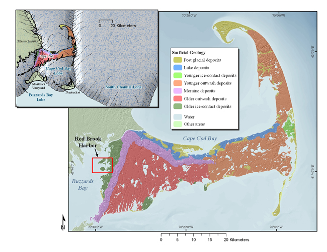
Figure 3. Map showing the surficial geology of Cape Cod, Massachusetts, with inset map showing surficial geology superimposed on the southernmost extent of the Laurentide ice sheet (from Oldale, 1992).  (Hillshade image from [Massachussets] Office of Geographic Information (2010).)


Download the full size image in PDF format.


To view files in PDF format, download a free copy of Adobe Reader.


Skip USGS links group

Accessibility FOIA Privacy Policies and Notices

Take Pride in America logo USAGov logo U.S. Department of the Interior | U.S. Geological Survey
End of USGS links group