U.S. Geological Survey Open-File Report 2010–1100
Surficial Geology of the Sea Floor in Long Island Sound Offshore of Orient Point, New York
![]() Title |
List of Figures |
Conversion Factors |
Abstract |
Introduction |
Setting |
Methods |
Bathymetry |
Sidescan Sonar |
Sediments |
Bottom Photography |
GIS Data Catalog |
Summary |
Acknowledgments |
References |
Contacts
Title |
List of Figures |
Conversion Factors |
Abstract |
Introduction |
Setting |
Methods |
Bathymetry |
Sidescan Sonar |
Sediments |
Bottom Photography |
GIS Data Catalog |
Summary |
Acknowledgments |
References |
Contacts
 |
||
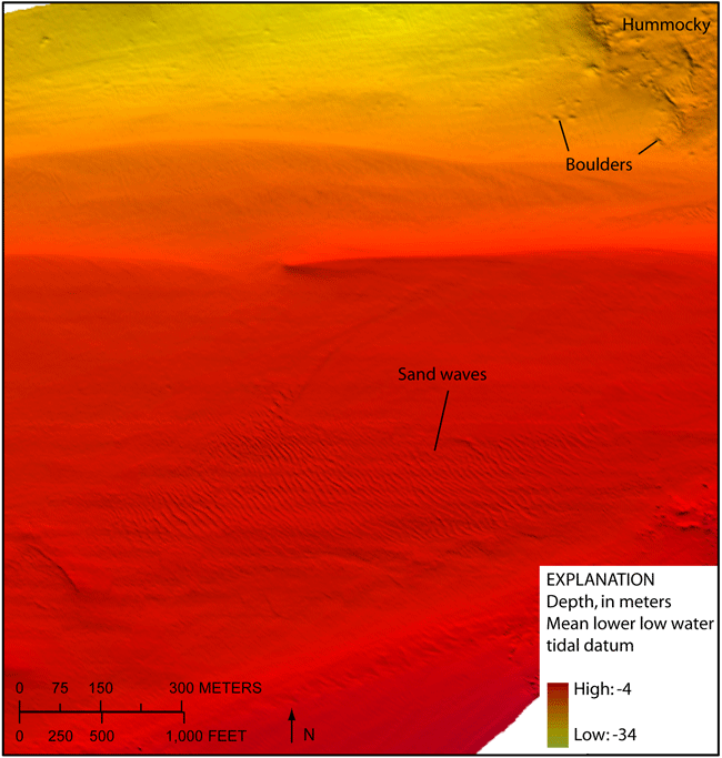
Figure 14. Detailed multibeam bathymetry image in the western part of the study area showing sand waves and a hummocky sea floor with boulders. The sand waves have 10- to 20-meter wavelengths. Location of image shown in figure 12. | ||


