U.S. Geological Survey Open-File Report 2010–1100
Surficial Geology of the Sea Floor in Long Island Sound Offshore of Orient Point, New York
![]() Title |
List of Figures |
Conversion Factors |
Abstract |
Introduction |
Setting |
Methods |
Bathymetry |
Sidescan Sonar |
Sediments |
Bottom Photography |
GIS Data Catalog |
Summary |
Acknowledgments |
References |
Contacts
Title |
List of Figures |
Conversion Factors |
Abstract |
Introduction |
Setting |
Methods |
Bathymetry |
Sidescan Sonar |
Sediments |
Bottom Photography |
GIS Data Catalog |
Summary |
Acknowledgments |
References |
Contacts
 |
||
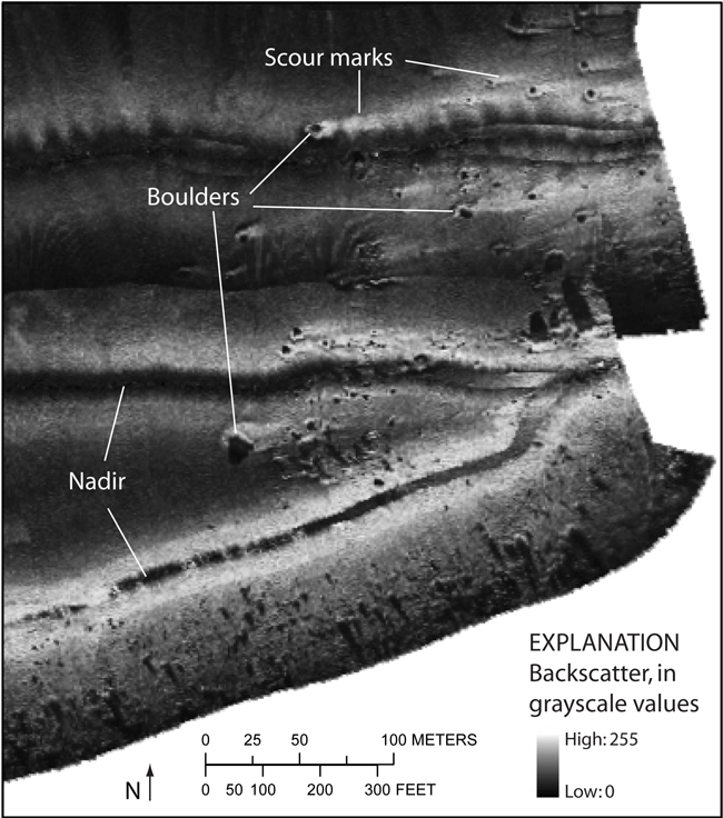
Figure 18. Detailed sidescan-sonar image of boulders with scour marks at the eastern end of the study area. Scour depressions to the east of the boulders indicate net eastward bottom currents; higher backscatter in the depressions indicates the presence of coarser grained sediments. Dark stripes in the middle of sonar lines are nadir gaps. Location of image shown in figure 17. | ||


