Skip past header information
USGS - science for a changing world
NOAA Logo with link to NOAA Home Page.CT DEP Logo with link to CT DEP Home Page.  

U.S. Geological Survey Open-File Report 2011–1003

Combined Multibeam and LIDAR Bathymetry Data from Eastern Long Island Sound and Westernmost Block Island Sound – A Regional Perspective


Skip past contents information

Title | List of Figures | Conversion Factors | Abstract | Introduction | Methods | Bathymetry | GIS Data Catalog | Summary | Acknowledgments | References | Contacts


Figure 16. A detailed bathymetric map showing a recessional moraine.

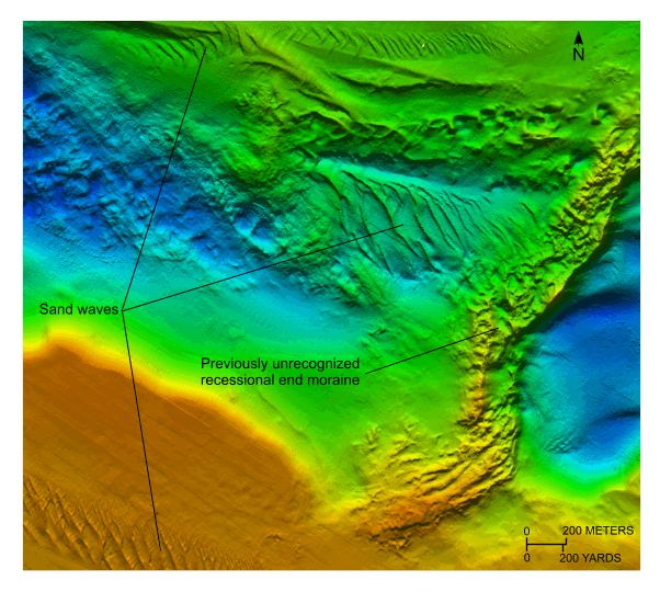
Figure 16. Detailed planar view of a previously unrecognized recessional end moraine in western Block Island Sound from the 4-meter digital terrain model (DTM) released in this report. Bathymetric data from this part of the DTM were originally collected during National Oceanic and Atmospheric Administration survey H11250. Location of view is shown in figure 12.

Skip USGS links group

Accessibility FOIA Privacy Policies and Notices

Take Pride in America logo USAGov logo U.S. Department of the Interior | U.S. Geological Survey
End of USGS links group