U.S. Geological Survey Open-File Report 2011–1004
Sea-Floor Geology and Character of Eastern Rhode Island Sound West of Gay Head, Massachusetts
 |
||
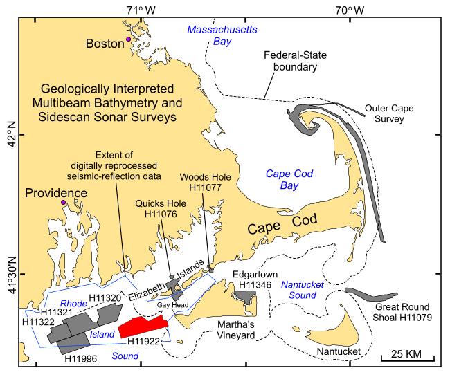
Figure 1. Index map of the coastal waters off southeastern New England showing location of the H11922 study area west of Martha's Vineyard, Massachusetts (red polygon). Also shown are (1) the locations of earlier studies off Massachusetts including the Outer Cape Survey (Poppe and others, 2006) and National Oceanic and Atmospheric Administration surveys H11076 – Quicks Hole (Poppe and others, 2007a), H11079 – Great Round Shoal Channel (Poppe and others, 2007b), H11077 – Woods Hole (Poppe and others, 2008), H11346 – Edgartown (Poppe and others 2010); (2) earlier studies off Rhode Island including H11320 (McMullen and others, 2007), H11321 (McMullen and others, 2008), H11322 (McMullen and others, 2009a), and H11996 (McMullen and others, 2011); and (3) the extent of digitally reprocessed seismic-reflection data (McMullen and others, 2009b) completed as part of this series (gray polygons). | ||


