U.S. Geological Survey Open-File Report 2011–1149
Sea-Floor Geology of Long Island Sound North of Duck Pond Point, New York
![]() Title |
List of Figures |
Conversion Factors |
Abstract |
Introduction |
Setting |
Methods |
Bathymetry |
Sediments |
Bottom Photography |
GIS Data Catalog |
Summary |
Acknowledgments |
References |
Contacts
Title |
List of Figures |
Conversion Factors |
Abstract |
Introduction |
Setting |
Methods |
Bathymetry |
Sediments |
Bottom Photography |
GIS Data Catalog |
Summary |
Acknowledgments |
References |
Contacts
 |
||
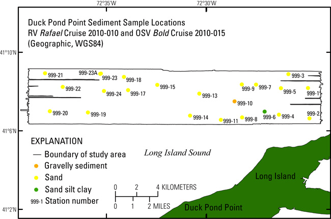
Figure 23. Map showing location of sediment samples collected during U.S. Geological Survey cruises 2010-010, aboard research vessel (RV) Rafael, and 2010-015, aboard U.S. Environmental Protection Agency ocean survey vessel (OSV) Bold, north of Duck Pond Point, New York. Most samples are sand, one is gravelly sediment and another is sand silt clay. WGS84, World Geodetic System 1984. |
||


