|
WRIR 99-4079: Estimates of Ground-Water Discharge as Determined from Measurements of Evapotranspiration, Ash Meadows Area, Nye County, Nevada |
|
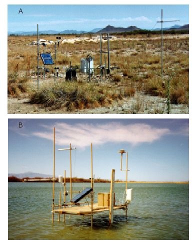
Figure 9. Typical instrument installations used to determine evapotranspiration (ET) from Ash Meadows area, Nevada. (A) LCFLAT site (pl. 1, table 6) established over moist bare soil (MBS, table 3). Vegetation is sparse and consists primarily of the bunchgrass, alkali sacaton (Sporobulus airoides). Soil is encrusted with thin layer of salt deposits. (B) PRESVR site established over open water (OWB, table 3).