In Fiscal Year 1998, the U.S. Geological Survey made a formal commitment to its customers by adopting a bureau-wide customer service policy developed by the bureau's Customer Service Team. This policy, which will become a chapter in the USGS Manual, reaffirms the USGS pledge to serve its customers with excellence. The policy outlines the USGS responsibility to work with customers to improve the practical value of the information, services, and products that it provides, as well as improving the delivery mechanisms used to distribute these. USGS employees are reminded by the policy of the importance of interacting proactively with customers, identifying their needs, and integrating these needs into USGS program planning and implementation. The policy also establishes a framework for complying with authorities, such as Executive Order 12862, "Setting Customer Service Standards," and the April 1998 Presidential Memorandum, "Conducting Conversations with America."
As part of the policy, USGS adopted the following standards for customer service. USGS customers should expect:
- Credible, relevant, impartial information about the natural sciences and the support systems for these sciences;
- Courteous and respectful treatment;
- Prompt and accurate answers to questions;
- Timely responses to information requests through single-point contact whenever possible;
- Customer input to be considered in USGS plans, programs, and services; and
- Prompt attention to mistakes and problems, and corrections made to repair these.
The policy also tasks USGS program managers with meeting requirements of the Executive Order including:
- Setting annual customer service goals,
- Measuring progress in meeting goals and ensuring these goals are achieved,
- Obtaining feedback from customers regarding services and products,
- Collecting data needed for an annual customer service progress report,
- Identifying opportunities for improvement,
- Identifying pilot opportunities for highlighting customer service, and
- Developing customer service performance measures and incorporating these into programs as part of the Government Performance and Results Act (GPRA) and annual performance planning process.
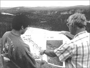
Field checking AVIRIS maps in Yellowstone National Park.
|
The USGS Customer Service Team continued to champion customer service within the bureau and to increase awareness of the importance of
working with customers. To develop ways to obtain customer feedback, the team submitted a request to the Office of Management and Budget to approve a three-year program of information collections regarding customer satisfaction with specific activities of the USGS. Once approved, the "generic clearance" to conduct such information collections will enable the USGS to formally survey its customers using a variety of tools including questionnaires, comment cards, web-based feedback surveys, and focus groups. All surveys will be voluntary and customers will be randomly sampled. A quantitative analysis of customer satisfaction data related to information, product and service timeliness, accuracy, usefulness, and quality will be made and used as a basis for continuous improvement. Copies of the master plan for conducting the three-year program of customer satisfaction information collections can be obtained by e-mailing customer@usgs.gov.
In Fiscal Year 1998, the USGS released a report to customers summarizing progress made in meeting our FY 1997 customer service goals. A copy of the report can be seen at https://pubs.usgs.gov/customer/1997/. The report also contains the USGS Fiscal Year 1998 Customer Service Plan.
The FY 1998 Customer Service Plan offers the following goals for USGS in 1998.
Goal 1: USGS customers are satisfied with our products, information and services.
Goal 2: USGS products are delivered to our customers in a timely and accurate manner.
Goal 3: Customer needs are integrated into USGS program planning and product development.
Goal 4: Products, services, and information provided by USGS to its customers make this a better world.
Highlights of progress in meeting these goals for FY 1998 follow.
Biological Resources Program's Annual Survey
The USGS Biological Resources Program sponsors an annual survey of its partners to determine satisfaction levels with various aspects of its service. Its most recent survey yielded some interesting findings, particularly as these relate to the way in which customers use USGS information. When asked about satisfaction with USGS biological research products, 98 percent of respondents who used these products; which include research findings published in reports, journal articles, monographs, and books; indicated that they were very satisfied or satisfied with these.
"All our management related to
brucellosis-infected mammals is based
on USGS information provided. We could not manage effectively without this information."
U.S. Fish and Wildlife
|
Of those responding, 99 per cent used technical assistance services (including assistance with application of research results, methods, and tools; site visits to advise or instruct; and written or phone consultations) and were very satisfied or satisfied with these services. Respondents to the survey provided concrete examples of how USGS biological resource program information is being used.
Also 75 percent indicated that they used this information to help them make land or resource decisions. For example, one customer noted that the "Data obtained from this USGS study resulted in major changes in commercial fishing practices in Prince William Sound, Alaska." Another noted that "The information, provided by USGS, was used for our analysis of effects to listed and sensitive species�for rulemaking that will address the conservation of the northern spotted owl on non-federal lands�The project involved incredible volumes of data and a rather complicated analysis. Without their USGS help, I do not think we could have completed this project as effectively." Such information is being used by the USGS not only to improve customer satisfaction levels with products, services, and information, but to meet customers expectations and, "make this a better world."
National Cooperative Geologic Mapping Program
The USGS National Cooperative Geologic Mapping Program identified its key customers and held a workshop in May 1998 to solicit input from these potential users of a USGS product: the National Geologic Map Database. Over 40 users representing other Federal agencies, State agencies, libraries, universities, museums, business and industry, and professional societies were presented with an overview of the Congressionally-mandated project. These customers were also given an opportunity to interact with the Internet-delivered prototype database. Participants suggested numerous improvements to the interface, content, and project schedule, and offered ideas for future cooperation with their own sectors. A summary of the workshop results was provided in September 1998 to all participants. The summary outlines plans for and progress toward implementing the suggestions collected from these customers. In addition, two geologic map user
forums in the Mid-Atlantic Region and the Central Great Lakes Region have been held to solicit customer input on improving geologic maps produced by the USGS. The Mid-Atlantic forum produced USGS Circular 1148 which documents how customer input was used in program planning. In response to customer needs expressed in the Great Lakes Forum, a new coalition between the USGS and the geologic surveys of Ohio, Indiana, Illinois, and Michigan was formed to map glacial sediments which contain critical ground water aquifers.
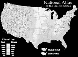
National Atlas
The National Atlas of the United States project is an Access America initiative under the Vice President's National Partnership for Reinventing Government. The Atlas is an interagency effort, led by the USGS, to make geographic information more accessible and useful to Americans. Products and information are online at this Universal Resource Locator (http://www..usgs.gov/atlas/).
It has been clear since the inception of the project that success could only be achieved through partnerships with other Government organizations and the private sector and through effective communication between National Atlas developers and the American public. Project managers sought and received Office of Management and Budget clearance to collect customer input and have since engaged in a number of activities designed to include public opinion in reaching product development decisions.
Decisions related to the development of National Atlas data and information products and the introduction of an online, interactive mapping system have greatly benefitted from public input. The USGS has used focus groups, in-person surveys, online surveys, and electronic mail exchanges as methods to solicit public views of a National Atlas. Americans voluntarily supply their views on thematic content, software functionality, and potential uses for a National Atlas. This enables the Government and its partners to concentrate early product development efforts on meeting the most important expectations and needs identified through rigorous customer assessment.
World Wide Web Increased Streamflow Data Available
|
"Your web versions of stream flow data is nothing short of superb. By printing out a station's data dialing in the week before a trip, an excellent picture of what is happening on the river is revealed to me...In short, thank you for providing a fantastic resource to the "river rats" of Virginia. True, we may look a little grizzled after a day or two on the water, but we appreciate good science with practical applications."
|
Building on the success of real-time streamflow information on the World Wide Web and the incredible response of customers to this kind of access, the USGS announced in March 1998 the availability of 160 million daily records of water data, spanning more than a century. Customers are now able to go into the data base (data from almost 19,000 stream gages are available online) and download needed information. In the past, such retrievals involved extensive discussion between customers and USGS staff about the retrieval and the format of output, and involved several days from initiation to data delivery. Retrievals now only take customers a few minutes from start to finish and require no intervention from USGS staff. Customers for this information include civil engineers doing water-resource design and planning work; Federal, State, and local officials responsible for water supply and discharge permitting; scientists and students researching natural resources; and citizens interested in river conditions within their own watershed. In June 1998, more than 320,000 pages of daily streamflow information were served to customers, 90 percent of which were outside the USGS. The daily streamflow records accessed in
June is a subset of the more than 1.5 million pages of information served by the USGS World Wide Web site at http://water.usgs.gov/.
Cooperative Research and Development Agreement with Microsoft
The USGS entered into a cooperative research and development agreement with Microsoft to build a geospatial data browsing and retrieval capability for the general public. The Web site that was developed as a result of this agreement displays browse images of the more than 60,000 digital orthophoto quadrangles available from the USGS, serving more than one terabyte of data. From its opening on June 24, the TerraServer Web site has averaged 3,000 simultaneous users and is shaping up to be an exceedingly popular site. At the site, users can download the browse image they have seen on their screen as well as go directly to USGS to order the digital orthophoto quadrangle files for the images they have viewed. This site has expanded customer access to USGS data and given the general public, as well as geospatial data users, an entirely new view of USGS digital orthophoto quadrangles. Customers who link to the site include a student who shows the TerraServer view of his neighborhood on his homepage and a Fairfax County teacher who will conduct a workshop for early elementary school teachers featuring the TerraServer and the USGS images as classroom tools to teach mapping. Law enforcement agencies are interested in using the browse images for a quick view of crime areas. As feedback from users of the TerraServer site continue, the USGS will be able to identify additional customers and uses for Digital Orthophoto data.
National Water Quality Assessment Program
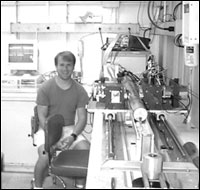
USGS employee analyzing a new sediment core
|
The production of summary reports on the first 20 study units of the USGS National Water Quality Assessment (NAWQA) Program on the status and trends of the quality of the Nation's surface and ground water resources provided an opportunity to directly deliver copies of these fact-filled reports to more than 1,000 customers who needs and use water-quality information in their daily responsibilities related to the country's water resources. This direct customer linkage effort is part of a developing customer contact data base that will ensure that USGS water resources information is delivered in a timely and proactive manner, as well as providing a feedback loop to continue to address the kind and manner of information delivered to customers.
PREVIOUS || TABLE OF CONTENTS || NEXT
This page is https://pubs.usgs.gov/98financial/service.html
Maintained by Eastern Publications Group Web Team
Last updated July 6, 1999