Gravity, Magnetic, and Radiometric Data for Newberry Volcano,
Oregon, and Vicinity
By Jeff Wynn
2014
 |
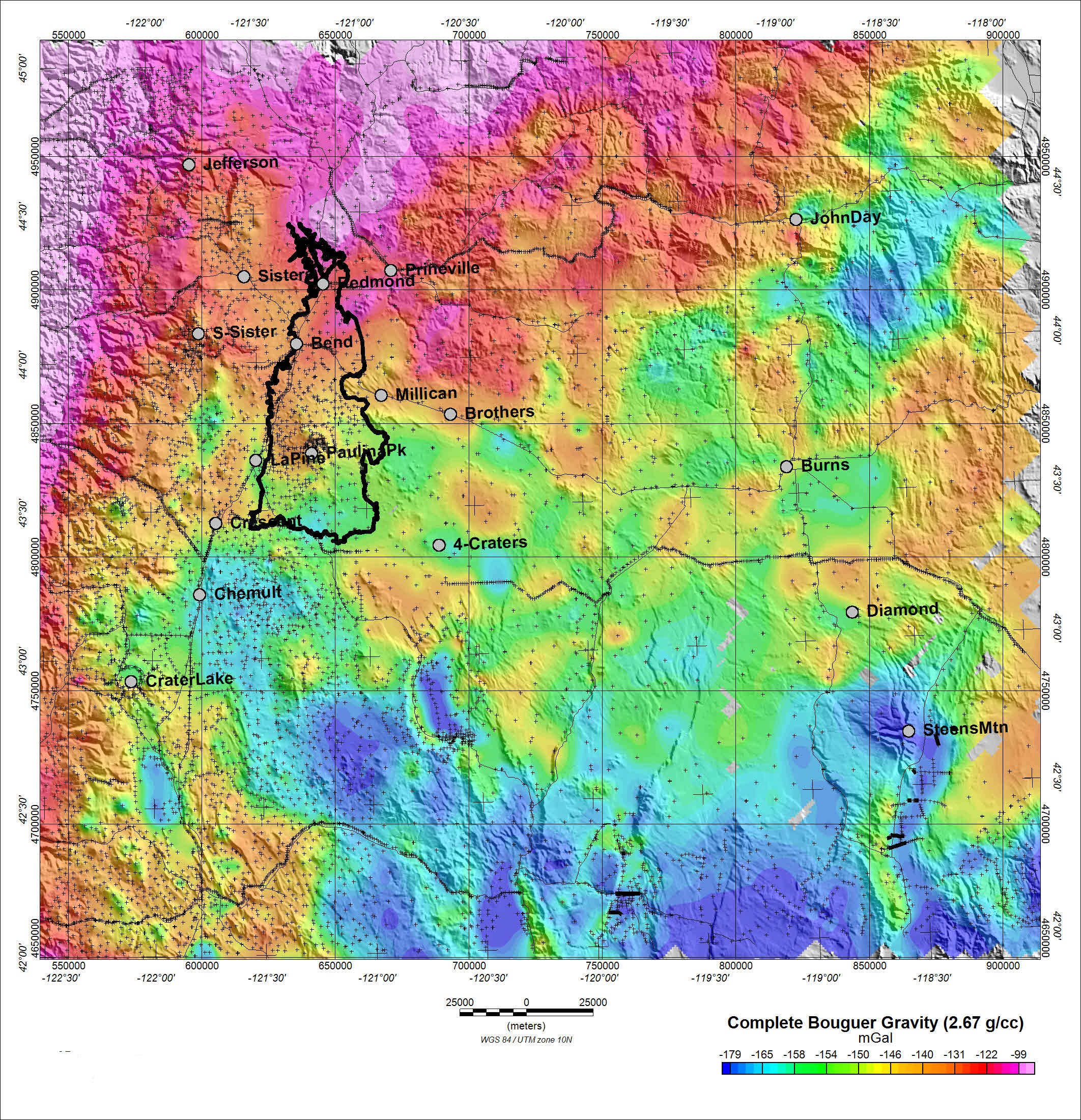
| Map of the complete Bouguer gravity of Newberry Volcano and vicinity, central Oregon. Black outline is the lava apron of the volcano, and small plus (+) symbols represent individual gravity stations. (Gravity anomaly reduced for a density of 2.67 grams per cubic centimeter (g/cc), in milliGals (mGal).) (Banner photograph shows a panorama of Newberry Volcano; USGS photo by Dave Ramsey.) |
|
Any use of trade, product, or firm names is for descriptive purposes only and does not imply endorsement by the U.S. Government.
Suggested citation:
Wynn, Jeff, 2014, Gravity, magnetic, and radiometric data for Newberry Volcano, Oregon, and vicinity: U.S. Geological Survey Data Series 830, https://dx.doi.org/10.3133/ds830.
U.S. Department of the Interior
SALLY JEWELL, Secretary
U.S. Geological Survey
Suzette M. Kimball, Acting Director
|