Data Series 858
Click on a segment name to view the contact sheet.
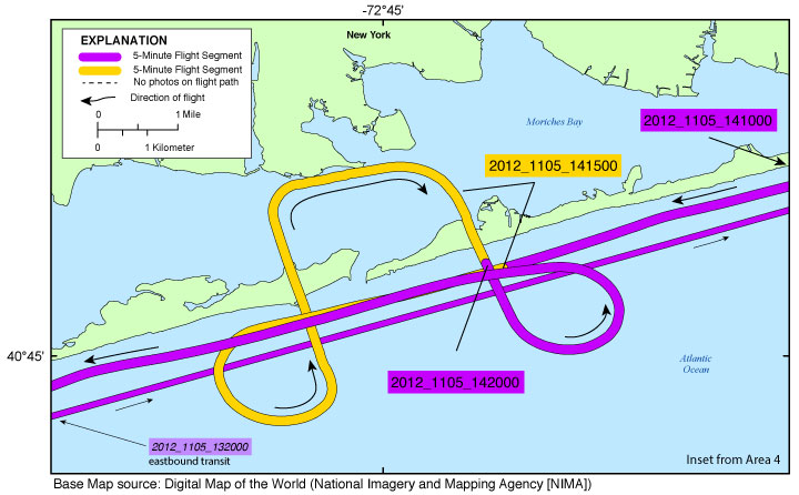
Figure 8. Map showing the Cupsoque Inset Map of the Post-Hurricane Sandy coastal oblique aerial survey from West Hampton Dunes to Smith Point County Park, N.Y., on November 5, 2012. Purple and yellow colored sections correspond to 5-minute flight segments that link to contact sheets of associated photo thumbnails. Click on the 5-minute segment name to view each contact sheet. Note: This map shows the survey path on November 5, which began at Long Island MacArthur Airport, Islip (ISP). The aircraft transited to the coastline then proceeded along the coast eastbound to the eastern tip of Long Island, Montauk Point. Some imagery was collected during the eastbound transit. Those images are found by clicking on the slightly smaller, italicized segment names. The flight then returned along the coast westbound along the southern exposure of Long Island, N.Y. |
Breezy Point Inset Map | Cupsoque Inset Map | Hatteras Inset Map | Mantoloking Inset Map | Mecox Inset Map
Ocean City Inset Map | Old Inlet Inset Map | Pea Island Inset Map | Rodanthe Inset Map | Wallops Island Inset Map

![]() U.S. Department of the Interior |
U.S. Geological Survey
U.S. Department of the Interior |
U.S. Geological Survey
URL: http://pubsdata.usgs.gov/pubs/ds/0858/html/ds858_inset_cupsoque.html
Page Contact Information: GS Pubs Web Contact
Page Last Modified: Monday, 28-Nov-2016 19:32:55 EST
