Data Series 858
Click on a segment name to view the contact sheet.
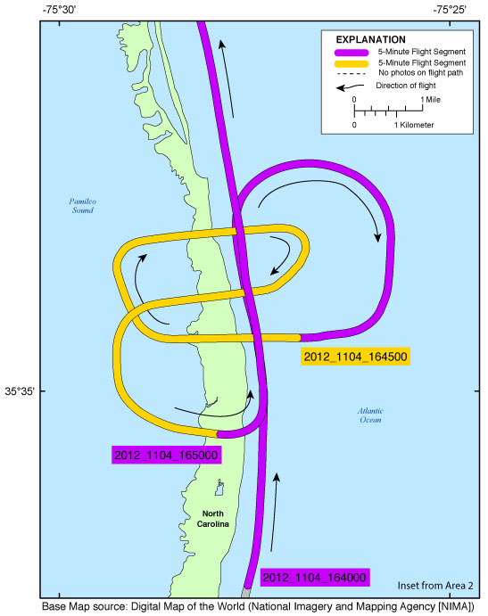
| Figure 5. Map showing the Rodanthe Inset Map of the Post-Hurricane Sandy coastal oblique aerial survey from Rodanthe to Hog Island, N.C., on November 4, 2012. Purple and yellow colored sections correspond to 5-minute flight segments that link to contact sheets of associated photo thumbnails. Click on the 5-minute segment name to view each contact sheet. |
Breezy Point Inset Map | Cupsoque Inset Map | Hatteras Inset Map | Mantoloking Inset Map | Mecox Inset Map
Ocean City Inset Map | Old Inlet Inset Map | Pea Island Inset Map | Rodanthe Inset Map | Wallops Island Inset Map

![]() U.S. Department of the Interior |
U.S. Geological Survey
U.S. Department of the Interior |
U.S. Geological Survey
URL: http://pubsdata.usgs.gov/pubs/ds/0858/html/ds858_inset_rodanthe.html
Page Contact Information: GS Pubs Web Contact
Page Last Modified: Monday, 28-Nov-2016 19:33:00 EST
