Skip Links

Data Series 860

Baseline Coastal Oblique Aerial Photographs Collected from Dauphin Island, Alabama, to Breton Island, Louisiana, August 8, 2012

Dauphin Island Inset Map


Skip Links

Home | Abbreviations | Contents | Photos and Maps | Navigation Data | Logs | Metadata | Index


Click on a segment name to view the contact sheet.
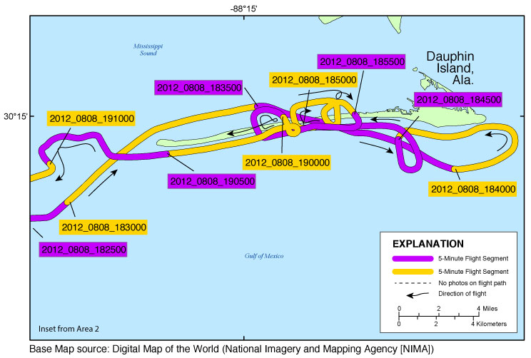
Dauphin Inset Map 2012_0808_182500 2012_0808_183000 2012_0808_190500 2012_0808_190000 2012_0808_184000 2012_0808_184500 2012_0808_185500 2012_0808_185000 2012_0808_183500 2012_0808_191000

Figure 6. Map showing the Dauphin Island, Alabama, area of the baseline coastal oblique aerial survey. Purple and yellow colored lines correspond to 5-minute flight segments that link to contact sheets of associated photo thumbnails. Click on the 5-minute segment name to view each contact sheet.


Full Survey Area | 12CCH02 - Area 1 | 12CCH02 - Area 2

Breton Island Inset Map | Dauphin Island Inset Map | Northern Benchmark Inset Map


Home | Abbreviations | Contents | Photos and Maps | Navigation Data | Logs | Metadata | Index