Data Series 913
|
|
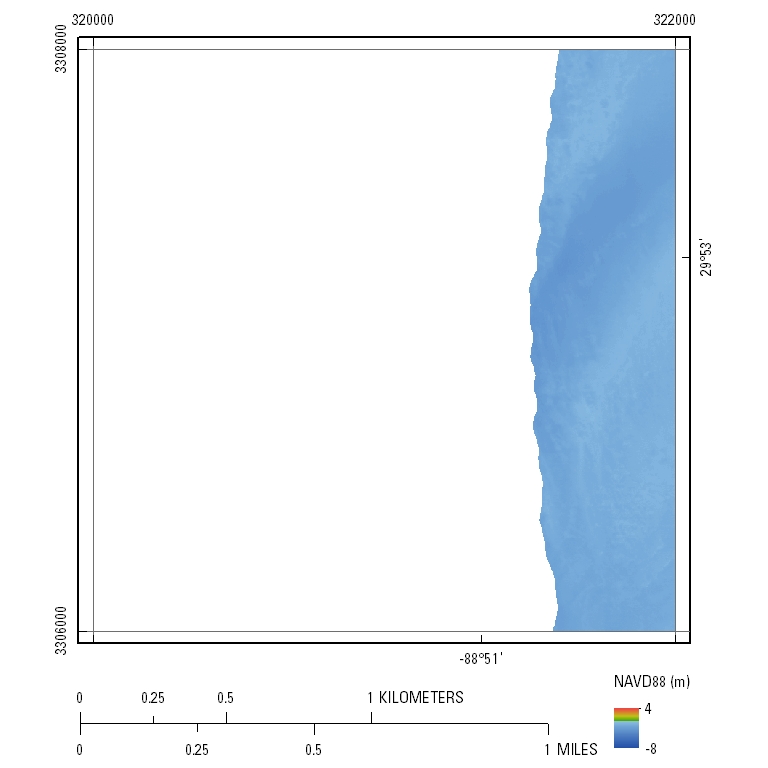
EAARL-B Coastal Topography–Chandeleur Islands, Louisiana, 2012: Seamless (Bare Earth and Submerged)UTM Tile e320_n3308_16Seamless Topography: 2.5-meter resolution
|

![]() U.S. Department of the Interior |
U.S. Geological Survey
U.S. Department of the Interior |
U.S. Geological Survey
URL: http://pubsdata.usgs.gov/pubs/ds/0913/html/tile_htmls/e320_n3308_16.html
Page Contact Information: GS Pubs Web Contact
Page Last Modified: Monday, 28-Nov-2016 20:34:33 EST