Skip Links

Data Series 945

Perdido Key Inset Map


Home | Abbreviations | Contents | Photos and Maps | Navigation Data | Logs | Metadata | Index


Click on a segment name to view the contact sheet.
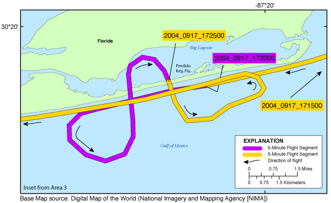
Perdido Key Inset Map ds945_2004_0917_171500 ds945_2004_0917_172000 ds945_2004_0917_172500
Figure 7. Perdido Key inset map (Area 3). Map showing the flight path of the post-Hurricane Ivan coastal oblique aerial survey at the east end of Perdido Key, Florida. Purple and yellow colored lines correspond to 5-minute flight segments that link to contact sheets of associated photo thumbnails. Click on the 5-minute segment name to view each contact sheet.


Full Survey Area | 04ACH03 - Area 1 | 04ACH03 - Area 2 | 04ACH03 - Area 3 | 04ACH03 - Area 4 | 04ACH03 - Area 5

Miramar Beach Inset Map | Fort Walton Beach Inset Map | Pensacola Beach Inset Map | Perdido Key Inset Map | Dauphin Island Inset Map
Gulf Shores Inset Map | Perdido Key (Return Transit) Inset Map

Home | Abbreviations | Contents | Photos and Maps | Navigation Data | Logs | Metadata | Index