Data Series 980
| Project SummaryTo document and assess the morphological storm response and post-storm beach recovery at Fire Island, New York, and as part of the ongoing beach monitoring within Hurricane Sandy Supplemental Project GS2-2B, the U.S. Geological Survey (USGS) St. Petersburg Coastal and Marine Science Center (SPCMSC) and the USGS Lower Mississippi-Gulf Water Science Center (LMG WSC) in Montgomery, Alabama, collected terrestrial-based light detection and ranging (T-lidar) elevation data along 35 kilometers of Fire Island beach (fig. 1). The data were collected on June 11, 2014. The resulting high-resolution beach morphology dataset documents the ongoing beach evolution and recovery occurring in 1.5 years since Hurricane Sandy on October 29, 2012. April 2013 and April 2014 Fire Island lidar beach elevation data are available at: https://dx.doi.org/10.3133/ds921 and https://dx.doi.org/10.5066/F77H1GNN.For more information, refer to the U.S. Geological Survey Fire Island Coastal Change Web site at: http://coastal.er.usgs.gov/fire-island/research/sandy/. 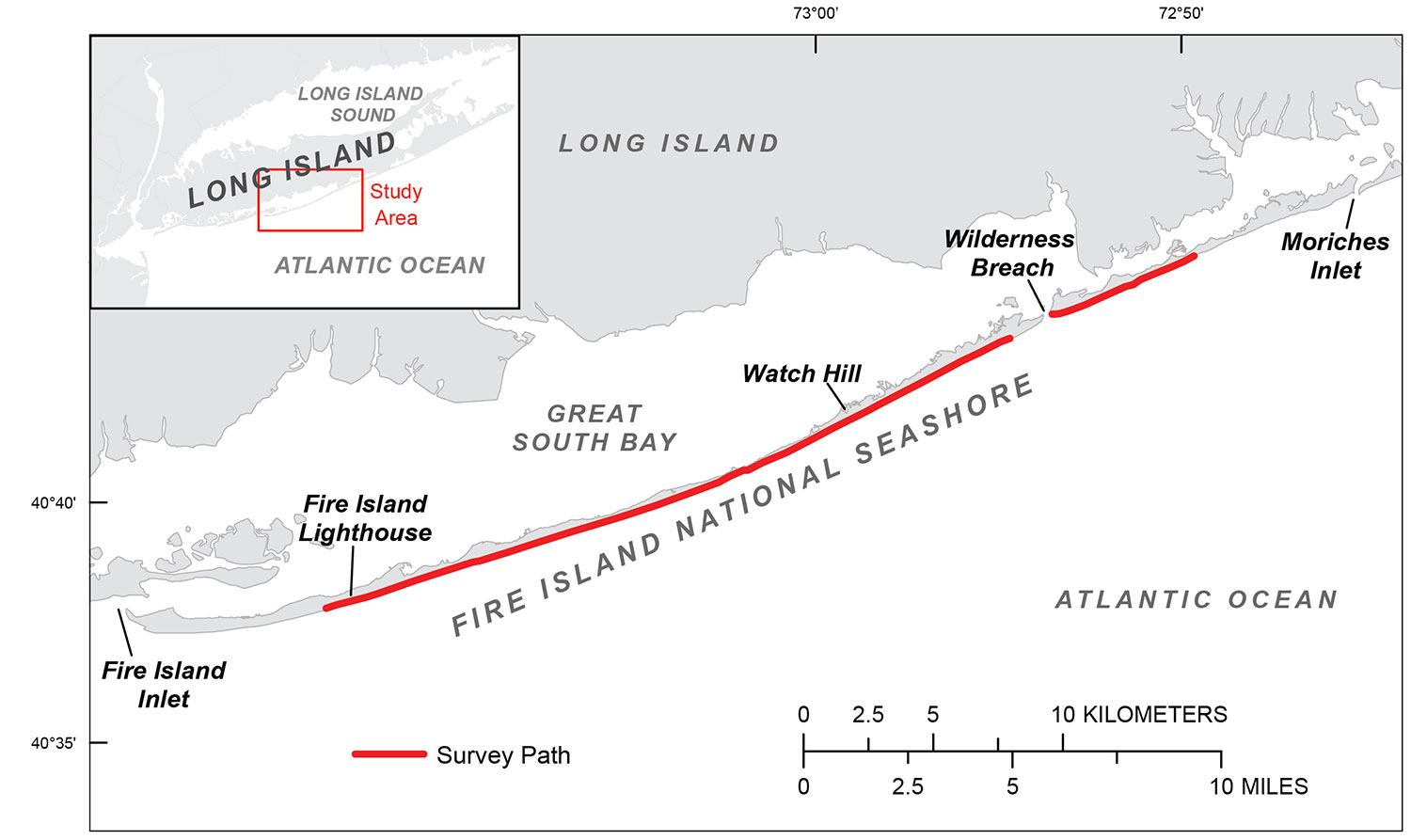 Figure 1. The June 11, 2014, terrestrial lidar beach survey includes 35 kilometers of the Fire Island National Seashore at Fire Island, New York. [larger version] |

![]() U.S. Department of the Interior |
U.S. Geological Survey
U.S. Department of the Interior |
U.S. Geological Survey
URL: http://pubsdata.usgs.gov/pubs/ds/0980/ds980_summary.html
Page Contact Information: GS Pubs Web Contact
Page Last Modified: Monday, 28-Nov-2016 20:45:22 EST
