USGS - science for a changing world

Data Series 1033

Post-Hurricane Katrina Coastal Oblique Aerial Photographs Collected From Panama City, Florida, to Lakeshore, Mississippi, and the Chandeleur Islands, Louisiana, August 31, 2005

Skip Links

Citation Page
Abstract
Introduction
Photographs and Maps
Navigation Data
Logs
Metadata
Abbreviations
 

Dauphin Island Inset Map

Click on a segment name to view the contact sheet.

Dauphin Island inset map ds1033_2005_0831_170500 ds1033_2005_0831_171000 ds1033_2005_0831_171500 ds1033_2005_0831_172000 ds1033_2005_0831_172500 ds1033_2005_0831_173000 ds1033_2005_0831_173500 ds1033_2005_0831_174000 ds1033_2005_0831_174500 ds1033_2005_0831_175000 ds1033_2005_0831_175500
Figure 5. Dauphin Island inset map (Area 2). Map showing the flight path of the post-Hurricane Katrina coastal oblique aerial survey of Dauphin Island, Alabama. Purple and yellow lines correspond to 5-minute flight segments that link to contact sheets of associated photograph thumbnails. Click on the 5-minute segment name to view each contact sheet.

Full Survey Area | 05CCH02: Area 1 | 05CCH02: Area 2 | 05CCH02: Area 3 | 05CCH02: Area 4

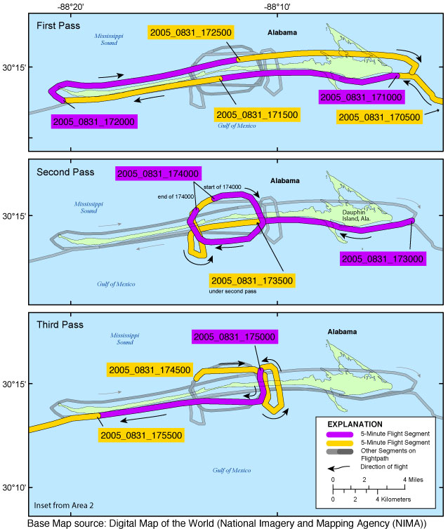
Navarre Inset Map | Dauphin Island Inset Map

Accessibility FOIA Privacy Policies and Notices

Take Pride in America logo USA.gov logo U.S. Department of the Interior | U.S. Geological Survey
URL: http://pubsdata.usgs.gov/pubs/ds/1033/html/ds1033_inset05_dauphin.html
Page Contact Information: GS Pubs Web Contact
Page Last Modified: Thursday, 23-Mar-2017 18:00:41 EDT