Data Series 1060
| Introduction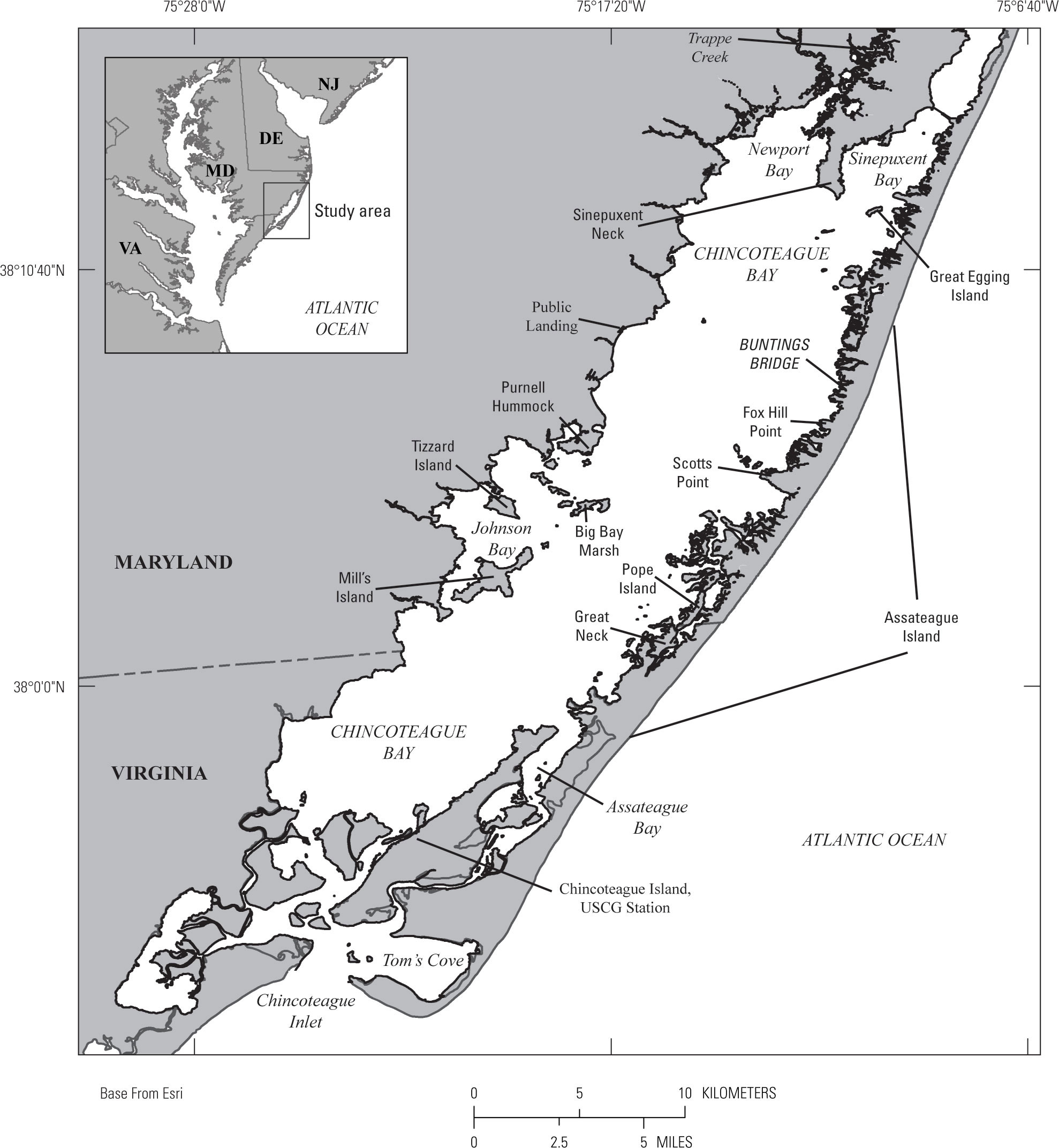 Figure 1. Map of the study area with relevant geographic locations labeled with a regional inlay. [Click image to enlarge] Scientists from the U.S. Geological Survey (USGS), St. Petersburg Coastal and Marine Science Center (SPCMSC) conducted a seasonal collection of estuarine, marsh, and sandy washover surface sediments from Chincoteague Bay, Tom’s Cove, and the surrounding Assateague Island and Delmarva Peninsula in March–April 2014 (Field activity number (FAN) 2014-301-FA) and October 2014 (2014-322-FA) after Hurricane Sandy. The sediment sampling efforts were part of a larger USGS study (Barrier Island and Estuarine Wetland Physical Change Assessment) to: (1) create a baseline of the sediment distribution patterns in Chincoteague Bay and the provenance of those materials (Ellis and others, 2015), (2) understand the long-term geologic processes occurring on and around Assateague Island and the mainland marshes of the Delmarva Peninsula, and (3) provide ground-truth measurements for remote sensing analysis (Smith and others, 2015). The data associated with the above-listed Open File Reports (OFRs) include site information, water quality parameters, sediment parameters (bulk density, water content, loss on ignition (LOI)), grain-size parameters, calculated stress thresholds, x-radiographs of marsh cores, photographs of peat augers, and alpha spectroscopy data (Ellis and others, 2015; Smith and others, 2015). In addition to the data listed above, micropaleontology samples were collected for foraminiferal assemblage analysis, and surplus material from the sediment parameters split was analyzed for metals, percent carbon and nitrogen, δ13C, and δ15N as part of a complementary USGS Coastal and Marine Geology Program (CMGP) Sea-level and Storm Impacts on Estuarine Environments and Shorelines (SSIEES) project study. For comparison with the estuarine, marsh, and overwash deposited foraminifera, a group of scientists from the USGS Woods Hole Coastal and Marine Science Center (WHCMSC) in Massachusetts collected sediment samples aboard the motor vessel (M/V) Scarlett Isabella offshore of Assateague Island on the inner continental shelf during a seafloor mapping study between June 15 and July 25, 2014 (Pendleton and others, 2016). Select samples were then shipped to the SPCMSC for foraminiferal analysis. The micropaleontological subsamples analyzed for foraminifera may be used to establish a baseline foraminiferal assemblage that accounts for some seasonal variability of the various species, regarding density and geographic extent, which are influenced by transient and stable environmental parameters. By understanding what parameters affect the various foraminiferal assemblages, researchers can delineate how alterations in salinity, temperature, or marsh-to-bay interactions, such as marsh erosion, may affect that assemblage. The use of foraminifera with other proxies, including metals, percent and stable carbon and nitrogen isotopes, and grain-size properties, allows for a more comprehensive understanding of the changes–and their extent– that result from increased or decreased terrestrial and anthropogenic inputs (such as marsh erosion, sewage outfall, or fertilizer run-off), or storm events (such as alterations to water quality parameters or sediment sources). |

![]() U.S. Department of the Interior |
U.S. Geological Survey
U.S. Department of the Interior |
U.S. Geological Survey
URL: http://pubsdata.usgs.gov/pubs/ds/1060/ds1060_intro.html
Page Contact Information: GS Pubs Web Contact
Page Last Modified: Tuesday, 31-Oct-2017 11:30:17 EDT
