Center for Coastal and Watershed Studies

Center for Coastal & Watershed Studies > Data Series 201A

Gulf of Mexico and Southeast Tidal Wetlands Satellite Imagery: Florida Big Bend Landsat MSS 1973-1987

DS 201A
by Ellen A. Raabe

Gulf of Mexico and Southeast Tidal Wetlands Satellite Imagery: Florida Big Bend
Landsat Imagery:
  North Area - Landsat Path 18 Row 39
  South Area - Landsat Path 17 Row 40
Contact Information

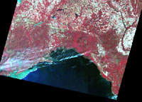
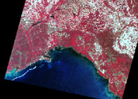
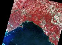
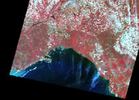
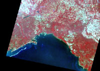
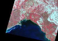
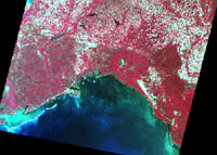
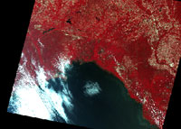
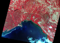
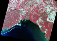
Big Bend North Imagery Landsat MSS 18/39

Each multi-band GeoTIFF image file includes all associated processed bands and indices for that acquisition date. Details are described in the metadata file.

To view full-scale images, select from imagery thumbnails, browse to the GeoTiffs/north_big_bend_fl folder, and download desired image or use the "open with" command to open image with preferred software.

mssN730412.jpg
Date acquired: 04-12-73
File name: mssN730412.tif
mssN740604.jpg
Date acquired: a04-07-74
File name: mssN740407.tif
mssN750604.jpg
Date acquired: 06-04-75
File name: mssN750604.tif
mssN760405.jpg
Date acquired: 04-05-76
File name: mssN760405.tif
mssN790619.jpg
Date acquired: 06-19-79
File name: mssN790619.tif
mssN810415.jpg
Date acquired: 04-15-81
File name: mssN810415.tif
mssN830416.jpg
Date acquired: 04-16-83
File name: mssN830416.tif
mssN840426.jpg
Date acquired: 04-26-84
File name: mssN840426.tif
mssN850429.jpg
Date acquired: 04-29-85
File name: mssN850429.tif
mssN870419.jpg
Date acquired: 04-19-87
File name: mssN870419.tif


Accessibility FOIA Privacy Policies and Notices

Take Pride in America home page. FirstGov button U.S. Department of the Interior | U.S. Geological Survey
URL: https://pubs.usgs.gov/ds/2006/201/201a/north-area.html
Page Contact Information: Feedback
Page Last Modified: December 5, 2006 (JSS)