USGS, NOAA, FEMA
U.S. Geological Survey
Data Series 236
Version 1.0
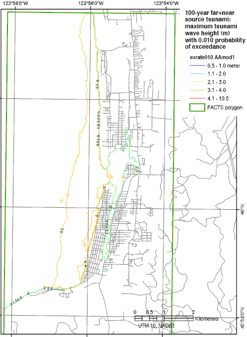
data layer: exrate010aa100-year flood, model AA1: 100-year tsunami map from probabilistic tsunami hazard analysis (PTHA) in which only Model 1 for Aleutian-Alaska earthquakes is used (Tsunami Pilot Study Working Group, 2006).
|
Report Home |
Top | Menu | Abbreviations

![]() U.S. Department of the Interior | U.S. Geological Survey
U.S. Department of the Interior | U.S. Geological Survey
URL: https://pubsdata.usgs.gov/pubs/ds/2006/236/figures/aamodel1.shtml
Page Contact Information: Florence L. Wong
Page Last Modified: Monday, 28-Nov-2016 12:02:08 EST(flw)