USGS, NOAA, FEMA
U.S. Geological Survey
Data Series 236
Version 1.0
data layer: dem_sources (polygons)Coverage areas of bathymetric data sources used in the digital elevation model (DEM). The Necanicum River region was estimated from limited light detection and ranging (LIDAR) data and estimates from Horning (Appendix C, Tsunami Pilot Study Working Group, 2006). The coverage areas were clipped to the study area boundaries for display purposes; however, the selected data sources extend beyond the boundary to avoid interpolation edge errors during grid development (Venturato, 2005). The number (for example, H08417) within each polygon is the NOAA National Ocean Service (NOS) hydrographic survey reference number. 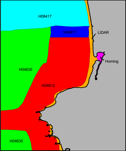 |
Report Home |
Top | Menu | Abbreviations

![]() U.S. Department of the Interior | U.S. Geological Survey
U.S. Department of the Interior | U.S. Geological Survey
URL: https://pubsdata.usgs.gov/pubs/ds/2006/236/figures/dem_sources.shtml
Page Contact Information: Florence L. Wong
Page Last Modified: Monday, 28-Nov-2016 12:02:12 EST(flw)


