USGS, NOAA, FEMA
U.S. Geological Survey
Data Series 236
Version 1.0
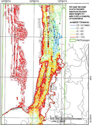
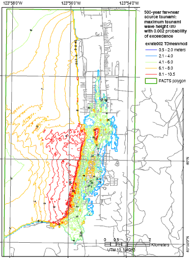
data layer: exrate002td480, exrate002td560Effect of mean inter-event time for Cascadia subduction zone earthquakes on probabilistic tsunami hazard analysis (PTHA) 500-year tsunami map (Tsunami Pilot Study Working Group, 2006). A, Map using a mean inter-event time less than 500 years (477 years).
B, Map using a mean inter-event time of 610 years.
|
Report Home |
Top | Menu | Abbreviations

![]() U.S. Department of the Interior | U.S. Geological Survey
U.S. Department of the Interior | U.S. Geological Survey
URL: https://pubsdata.usgs.gov/pubs/ds/2006/236/figures/evt_time.shtml
Page Contact Information: Florence L. Wong
Page Last Modified: Monday, 28-Nov-2016 12:02:13 EST(flw)