USGS, NOAA, FEMA
U.S. Geological Survey
Data Series 236
Version 1.0
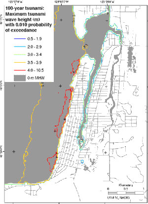
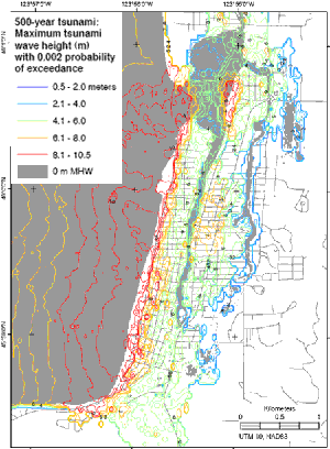
100- and 500-year tsunami floods modeled by Probabilistic Tsunami Hazard AnalysisTsunami wave heights (m) with (A) a 1 percent and (B) a 0.2 percent annual probability of exceedance (Tsunami Pilot Study Working Group, 2006). Wave heights include the effects of tides.
|
Report Home |
Top | Menu | Abbreviations

![]() U.S. Department of the Interior | U.S. Geological Survey
U.S. Department of the Interior | U.S. Geological Survey
URL: https://pubsdata.usgs.gov/pubs/ds/2006/236/figures/f_100-500cont.shtml
Page Contact Information: Florence L. Wong
Page Last Modified: Monday, 28-Nov-2016 12:02:14 EST(flw)