USGS, NOAA, FEMA
U.S. Geological Survey
Data Series 236
Version 1.0
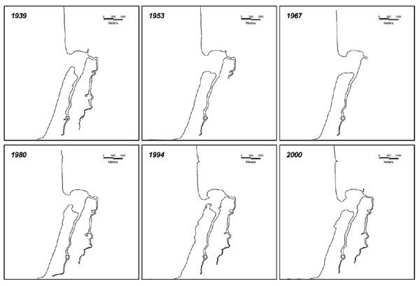
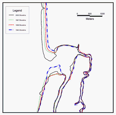
Historic ShorelinesData layers containing historic shorelines of the Seaside, Oregon, area are provided in vector format. The data were developed to analyze accretion and erosion trends along the dynamic Seaside and Necanicum River coast (Venturato, 2005). (A) Historic shoreline depicting the apparent Mean High Water line based on orthophotography obtained from the University of Oregon.
 |
Report Home |
Top | Menu | Abbreviations

![]() U.S. Department of the Interior | U.S. Geological Survey
U.S. Department of the Interior | U.S. Geological Survey
URL: https://pubsdata.usgs.gov/pubs/ds/2006/236/figures/historicshorelines.shtml
Page Contact Information: Florence L. Wong
Page Last Modified: Monday, 28-Nov-2016 12:02:19 EST(flw)