USGS, NOAA, FEMA
U.S. Geological Survey
Data Series 236
Version 1.0
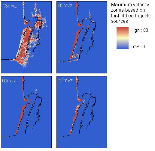
data layer: maximum velocity zones, far-fieldssmvzXX (grid) for model XX = 1 to 14Results of high-velocity wave hazard (tentative tsunami V zone) calculation from selected models of far-field tsunami sources. Non-zero values define the tsunami V zone; high values of the non-dimensional metric reflect shallow flow depths and high flow velocities (Tsunami Pilot Study Working Group, 2006).
|
Report Home |
Top | Menu | Abbreviations

![]() U.S. Department of the Interior | U.S. Geological Survey
U.S. Department of the Interior | U.S. Geological Survey
URL: https://pubsdata.usgs.gov/pubs/ds/2006/236/figures/maxvzfar.shtml
Page Contact Information: Florence L. Wong
Page Last Modified: Monday, 28-Nov-2016 12:02:09 EST(flw)