USGS, NOAA, FEMA
U.S. Geological Survey
Data Series 236
Version 1.0
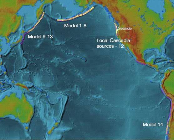
data layer: farfield_sourcesEarthquake source regions from Facility for the Analysis and Comparison of Tsunami Simulations (FACTS) database used for propagation modeling. Far-field sources are numbered 1 to 14 (Tsunami Pilot Study Working Group, 2006).
|
Report Home |
Top | Menu | Abbreviations

![]() U.S. Department of the Interior | U.S. Geological Survey
U.S. Department of the Interior | U.S. Geological Survey
URL: https://pubsdata.usgs.gov/pubs/ds/2006/236/figures/sourcesfar.shtml
Page Contact Information: Florence L. Wong
Page Last Modified: Monday, 28-Nov-2016 12:02:25 EST(flw)