USGS, NOAA, FEMA
U.S. Geological Survey
Data Series 236
Version 1.0
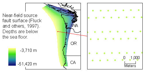
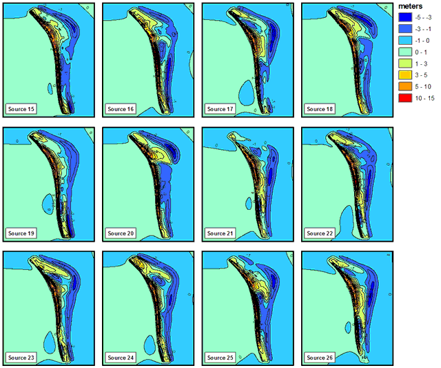
data layers: near-field earthquake sourcessourceXX (grid) for XX = 15 to 26A, Points are centroids of triangular areas for which slip was specified for each of the source scenarios in the lower image.
B, Source scenarios (coseismic vertical displacement) of Mw~9 Earthquakes for Cascadia Subduction Zone (Tsunami Pilot Study Working Group, 2006)
|
Report Home |
Top | Menu | Abbreviations

![]() U.S. Department of the Interior | U.S. Geological Survey
U.S. Department of the Interior | U.S. Geological Survey
URL: https://pubsdata.usgs.gov/pubs/ds/2006/236/figures/sourcesnear.shtml
Page Contact Information: Florence L. Wong
Page Last Modified: Monday, 28-Nov-2016 12:02:26 EST(flw)