USGS, NOAA, FEMA
U.S. Geological Survey
Data Series 236
Version 1.0
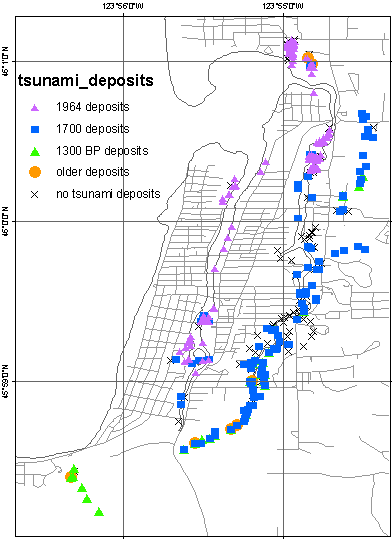
data layer: tsunami_depositsLocations for tsunami deposits sampled with gouge core and by trenching by Fiedorowicz and Peterson (Fiedorowicz, 1997; Feidorowicz and Peterson, 2002), and Jaffe and others (2004).
|
Report Home |
Top | Menu | Abbreviations

![]() U.S. Department of the Interior | U.S. Geological Survey
U.S. Department of the Interior | U.S. Geological Survey
URL: https://pubsdata.usgs.gov/pubs/ds/2006/236/figures/tsunami_deposits.shtml
Page Contact Information: Florence L. Wong
Page Last Modified: Monday, 28-Nov-2016 12:02:28 EST(flw)