USGS, NOAA, FEMA
U.S. Geological Survey
Data Series 236
Version 1.0
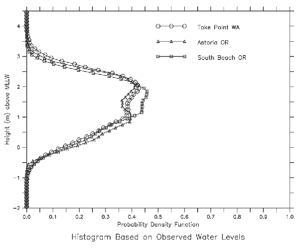
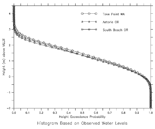
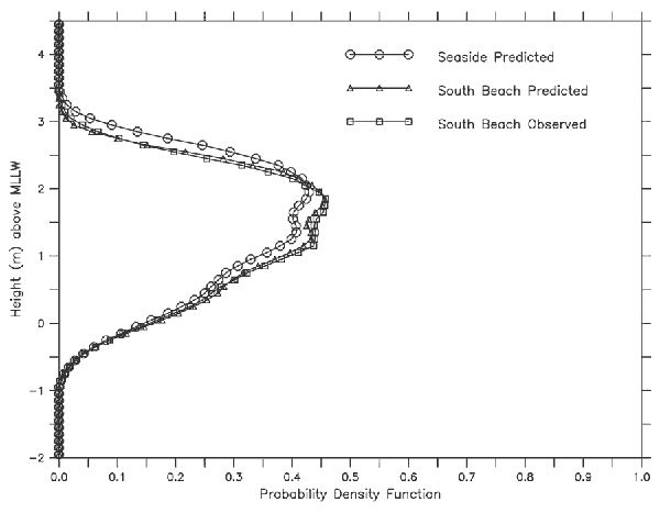
Water level probability distributionsData layers containing observed and predicted water levels and probability distributions for the study region are provided. The data were developed based on methods described in Mofjeld and others (2004).A, Probability density functions computed from observed water levels at the nearest long-term tide stations to Seaside, Oregon B, Exceedance probabilities computed from hourly water levels at the nearest long-term tide stations to Seaside, Oregon. C, Probability density functions (pdfs) computed from predicted water levels at South Beach and Seaside. Also shown is the pdf computed from observed water levels at South Beach, Oregon. |
Report Home |
Top | Menu | Abbreviations

![]() U.S. Department of the Interior | U.S. Geological Survey
U.S. Department of the Interior | U.S. Geological Survey
URL: https://pubsdata.usgs.gov/pubs/ds/2006/236/figures/waterlevelprobabilities.shtml
Page Contact Information: Florence L. Wong
Page Last Modified: Monday, 28-Nov-2016 12:02:29 EST(flw)