Data Series 119
Archive of Digital Boomer Seismic Reflection Data Collected During USGS Field Activity 04SGI01 in the Withlacoochee River of West-Central Florida, March 2004
By Karynna Calderon,1 Shawn V. Dadisman,2 Dann K. Yobbi,3 W. Scott McBride,3 James G. Flocks,2 and Dana S. Wiese2
1CSC, St. Petersburg, FL 33701.
2U.S. Geological Survey, St. Petersburg, FL 33701.
3U.S. Geological Survey, Tampa, FL 33612.
U.S. Department of the Interior
U.S. Geological Survey
Florida Integrated Science Center - St. Petersburg
|
Publications are available from USGS Information Services, |
 |
 |
|||
Information Statement
This DVD publication was prepared by an agency of the United States Government. Neither the United States Government nor any agency thereof nor any of their employees makes any warranty, expressed or implied, or assumes any legal liability or responsibility for the accuracy, completeness, or usefulness of any information, apparatus, product, or process disclosed in this report or represents that its use would not infringe privately owned rights. Reference therein to any specific commercial product, process, or service by trade name, trademark, manufacturer, or otherwise does not constitute or imply its endorsement, recommendation, or favoring by the United States Government or any agency thereof.
Although all data and software published on this DVD have been used by the USGS, no warranty, expressed or implied, is made by the USGS as to the accuracy of the data and related materials and (or) the functioning of the software. The act of distribution shall not constitute any such warranty, and no responsibility is assumed by the USGS in the use of these data, software, or related materials.
Note: The Web version of this archive does not contain the SEG-Y Trace files. These files are very large and would require extremely long download times. To obtain the complete DVD archive, contact USGS Information Services at 1-888-ASK-USGS.
System Requirements
This DVD disc is readable on any computing platform that has standard DVD driver software installed. The minimum software requirements are a web browser, Acrobat Reader, and a text editor. Warning! The only supported web browsers that properly display all features of the interactive profiles are Internet Explorer 6 for Windows and Firefox 1.5 for all platforms
Project Summary
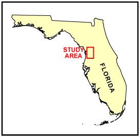
In March of 2004, the U.S. Geological Survey conducted a geophysical survey in the Withlacoochee River of west-central Florida. This report serves as an archive of unprocessed digital boomer seismic reflection data, trackline maps, navigation files, GIS information, Field Activity Collection System (FACS) logs, observer's logbook, and FGDC metadata. Filtered and gained digital images of the seismic profiles are also provided. Refer to the Acronyms page for expansion of all acronyms and abbreviations used in this report.
The archived trace data are in standard Society of Exploration Geophysicists (SEG) SEG-Y format (Barry and others, 1975) and may be downloaded and processed with commercial or public domain software such as Seismic Unix (SU). Example SU processing scripts and USGS software for viewing the SEG-Y files (Zihlman, 1992) are also provided.
The data archived here were collected as part of a study to evaluate the connection between the Upper Floridan aquifer and the Withlacoochee River. This study is part of the USGS Surface Groundwater Interactions (SGI) Project. For further information about the study, please contact Dann Yobbi at dyobbi@usgs.gov.
The USGS Florida Integrated Science Center (FISC) - St. Petersburg assigns a unique identifier to each cruise or field activity. For example, 04SGI01 tells us the data were collected in 2004 for the Surface Groundwater Interactions (SGI) Project and the data were collected during the first field activity for that project in that calendar year. Refer to http://walrus.wr.usgs.gov/infobank/programs/html/definition/activity.html for a detailed description of the method used to assign the field activity ID. For more information about the trackline naming convention used, refer to the metadata.
The boomer is an acoustic energy source that consists of capacitors charged to a high voltage and discharged through a transducer in the water. The transducer is towed on a sled at the water surface and when discharged emits a short acoustic pulse, or shot, that propagates through the water and sediment column. The acoustic energy is reflected at density boundaries (such as the seafloor or sediment layers beneath the seafloor), detected by the receiver, and recorded by a PC-based seismic acquisition system. This process is repeated at timed intervals (e.g., 0.25 s) and recorded for specific intervals of time (e.g., 100 ms). In this way, a two-dimensional vertical image of the shallow geologic structure beneath the ship track is produced.
Coherent noise was detected on most of the profiles. Attempts to mitigate the noise had varying degrees of success and included frequent changes in the acquisition geometry and grounding of the power supply. The source of the noise remains uncertain, but a new generator or the engine propeller might be the origin. Figure 1 displays acquisition geometries for this field activity. For more information about the acquisition geometry, refer to the science logbook and handwritten FACS logs. Table 1 is a summary of acquisition parameters. See the digital FACS equipment log for details about the acquisition equipment used. Table 2 lists trackline statistics.
The unprocessed seismic data are stored in SEG-Y format (Barry and others, 1975). For a detailed description of the data format, refer to the SEG-Y Format page. See the How To Download SEG-Y Data page for download instructions. The printable profiles provided here are GIF images that were filtered and gained using Seismic Unix software. Refer to the Software page for details about the processing and examples of the processing scripts. The processed SEG-Y data were then exported to Chesapeake Technology, Inc. (CTI) SonarWeb software to produce an interactive version of the profile that allows the user to obtain a geographic location and depth from the profile for a curser position. This information is displayed in the status bar of the browser. Warning! The only supported web browsers that properly display all features of the interactive profiles are Internet Explorer 6 for Windows and Firefox 1.5 for all platforms. For all browsers, the status bar and JavaScript must be enabled. Firefox also requires "Change status bar text" to be checked under Advanced JavaScript Options. Caution–other browsers may result in spurious or no information given in the status window. The printable profile images and interactive profiles can be viewed from the Profiles page or from links on the trackline maps.
A summary of the navigation system used can be found in table 1, and a more detailed description is given in the digital FACS equipment log. To view the trackline maps and navigation files, and for more information about these items, see the Navigation page.
The original trace files for lines 04b04, 04b10, 04b16, 04b20, and 04b27 were divided into two trace files each (e.g., 04b04 became 04b04a and 04b04b) because the original total number of traces exceeded the maximum allowed by the processing software. No digital data were collected for line 04b29. Navigation is missing for shots 15,896-16,014 of line 04b11, the first 159 shots of line 04b16a, and the first 838 shots of line 04b22. On the trackline maps, the location of missing navigation data within a line is inferred by linear interpolation of first and last known data points. All data were collected from UTM Zone 17; however, the navigation equipment was incorrectly set to UTM Zone 18 for lines 04b01-04b19 during data collection. Consequently, each data set was processed with respect to the UTM reference zone it was created in.
DVD Organization
The Disc Contents page is a diagram of the location of all files and folders contained on this disc and provides links to these files and folders.
Getting Started
To access the information contained on this disc, use a web browser to open the file index.html. This report is divided into five sections: Navigation Data and Maps, Seismic Profiles, Field Activity Logs, Metadata, and Software. Links at the top and bottom of each page provide access to these sections. This report contains links to the USGS and collaborators or other resources that are only accessible if access to the Internet is available while viewing these documents. Warning! The only supported web browsers that properly display all features of the interactive profiles are Internet Explorer 6 for Windows and Firefox 1.5 for all platforms
Acknowledgments
Funding for this study was provided by the Federal-State Cooperative Water Program and the USGS Coastal and Marine Geology Program. This document was improved by the reviews of T.J. Smith and E.A. Shinn of the USGS in St. Petersburg, Florida.
References Cited
Barry, R.M., Cavers, D.A., and Kneale, C.W., 1975, Recommended standards for digital tape formats: Geophysics, v. 40, p. 344-352. Also available online at: http://www.seg.org/publications/tech-stand.
Zihlman, F.N., 1992, DUMPSEGY V1.0: A program to examine the contents of SEG-Y disk-image seismic data: U.S. Geological Survey Open-File Report 92-590, 28 p.

![]() U.S. Department of the Interior |
U.S. Geological Survey
U.S. Department of the Interior |
U.S. Geological Survey
URL: https://pubsdata.usgs.gov/pubs/ds/2007/119/index.html
Page Contact Information: Publishing Services
Page Last Modified: Monday, 28-Nov-2016 12:22:22 EST
