Prepared in cooperation with the U.S. Agency for International Development
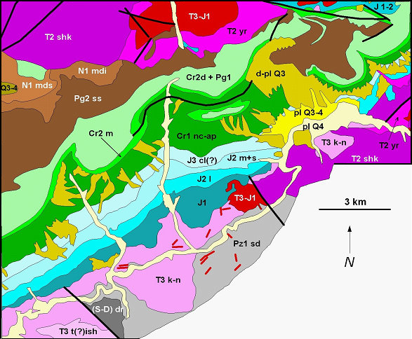
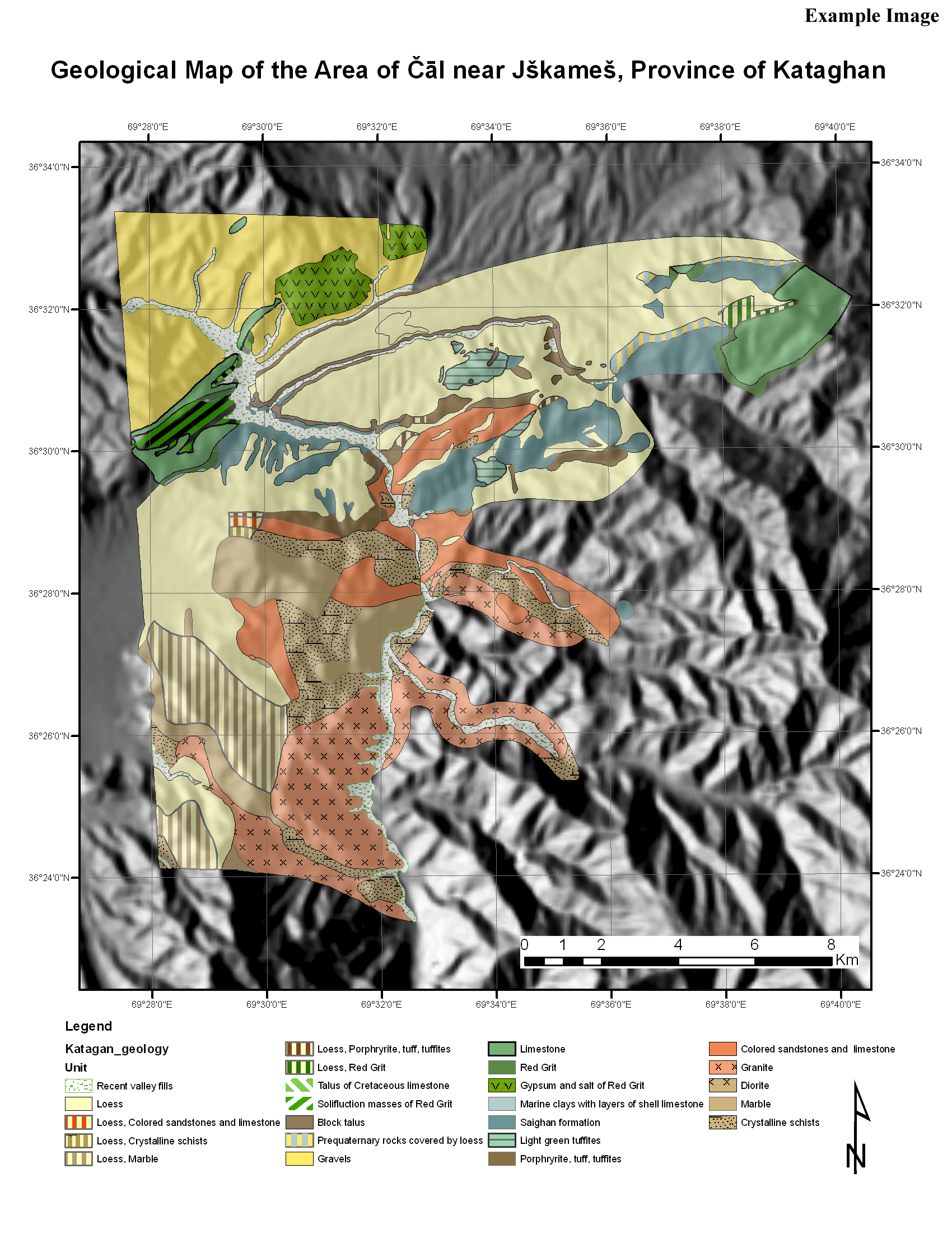
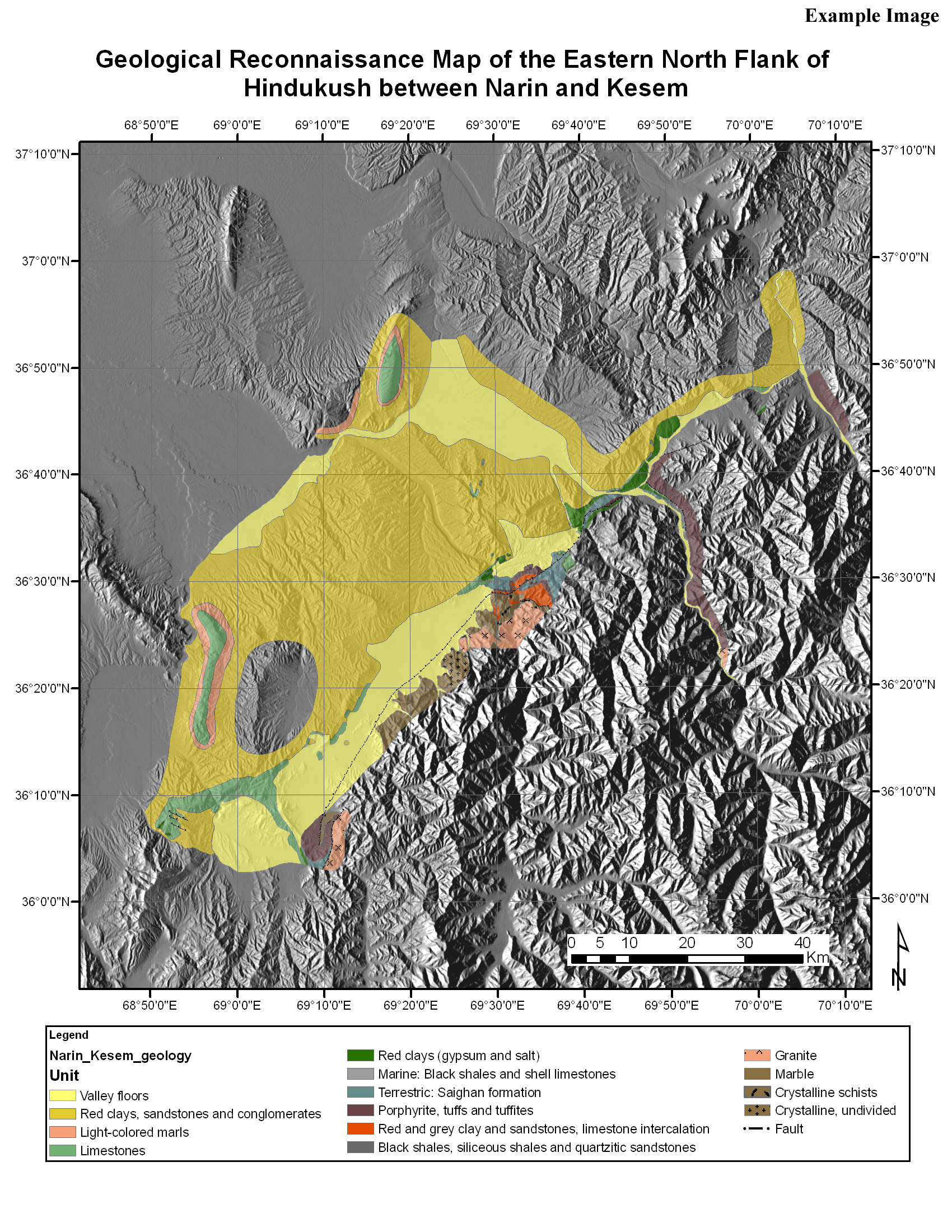
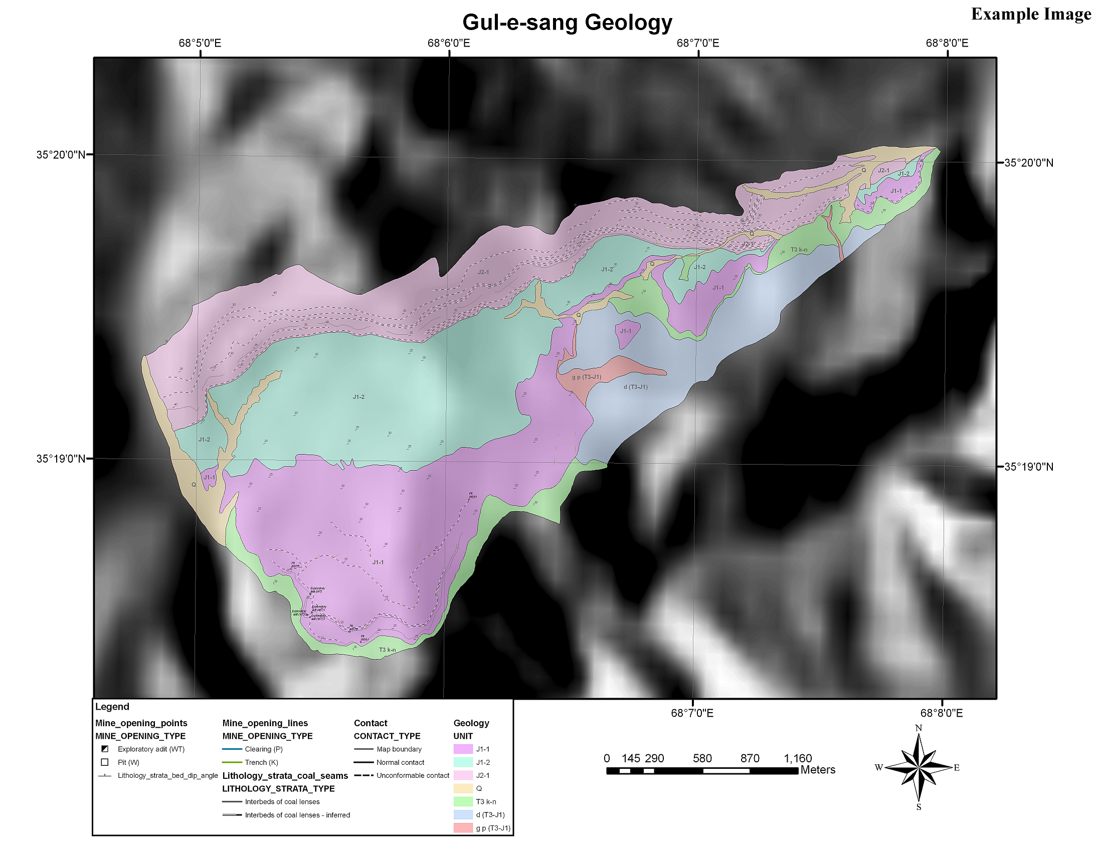
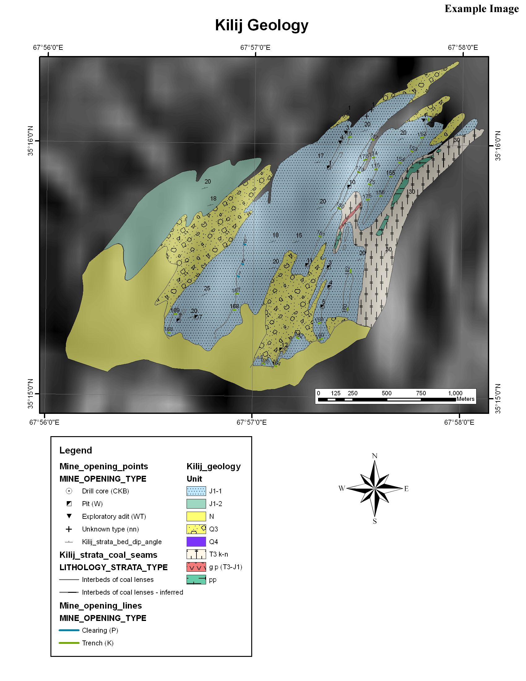
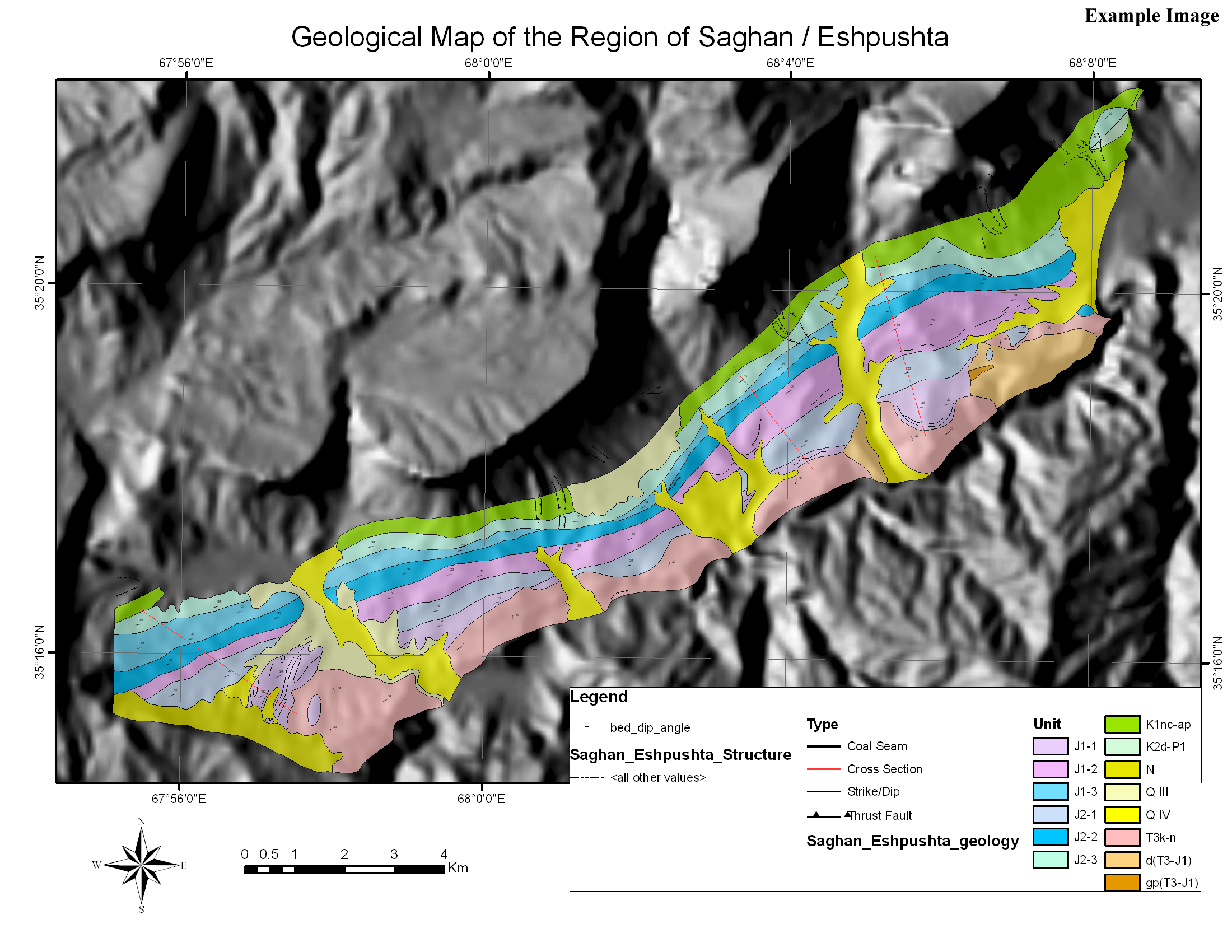
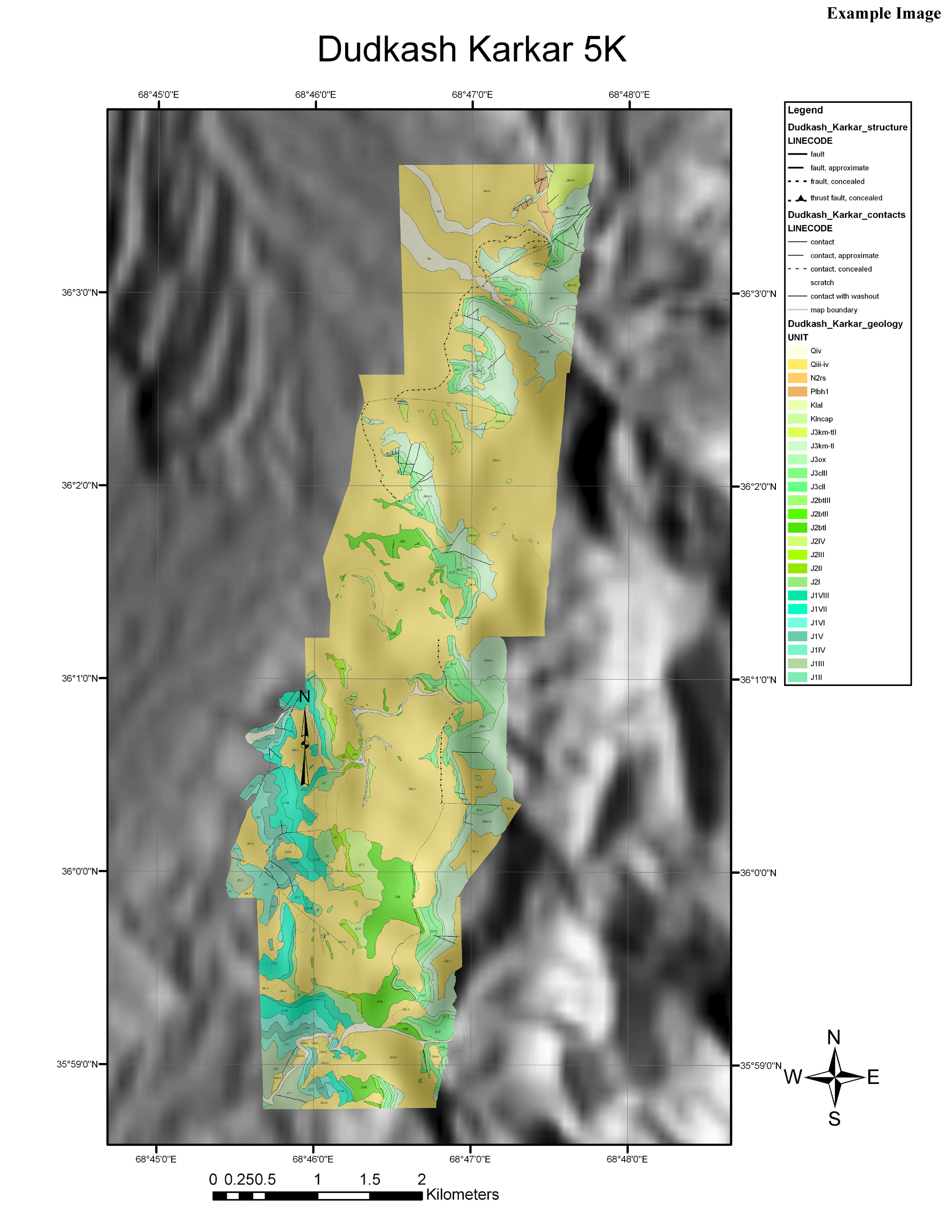
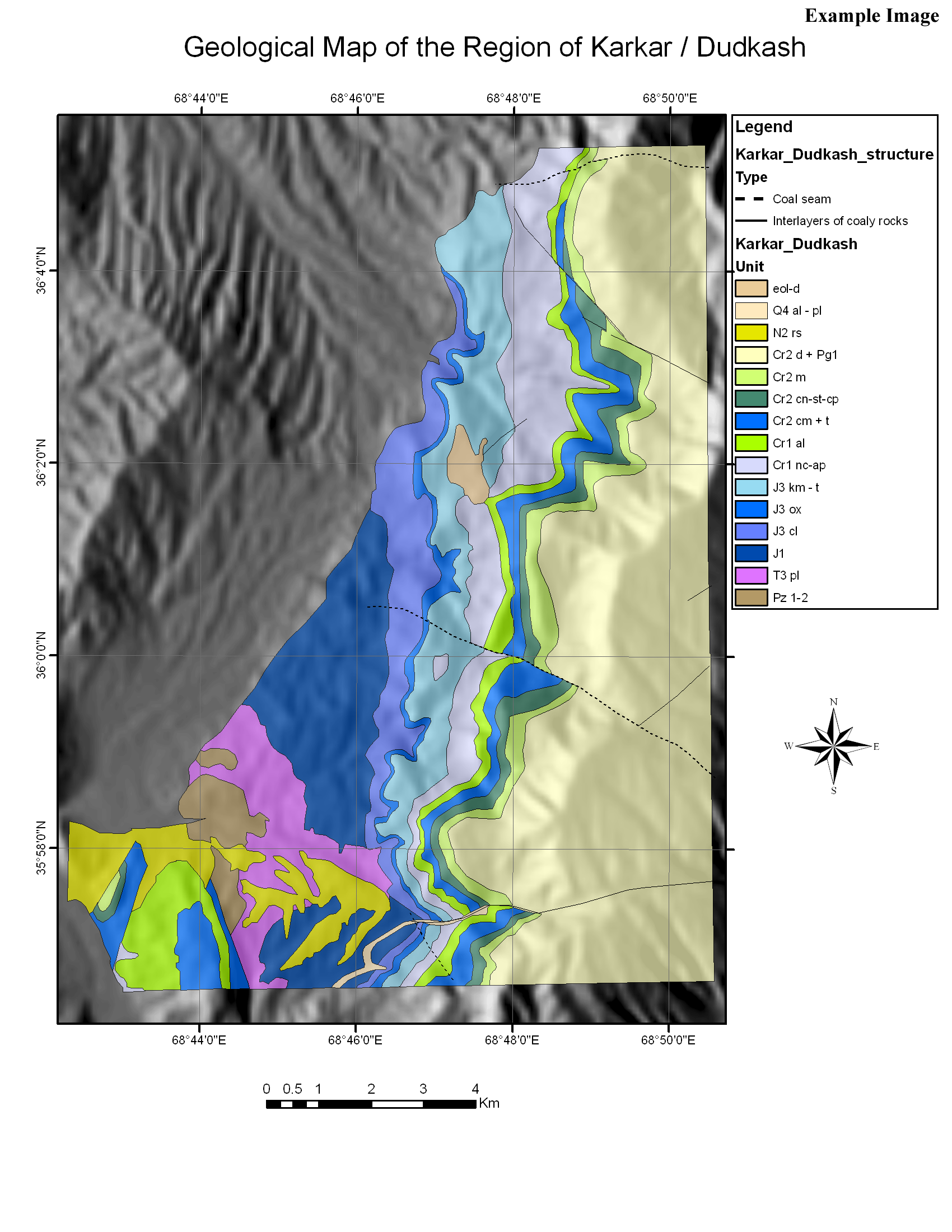
Example of a GIS Afghanistan coal map
This publication was completed under Interagency Agreement 306-P-00-04-00566-00 between the U.S. Agency for International Development and the U.S. Geological Survey (USGS Afghanistan Project Product No. 159).
This report describes the Afghanistan coal resource maps and associated databases that have been digitally captured and maps that have been thus far converted to GIS databases. Several maps by V/O Technoexport, USSR (VOTU) and Bundesanstalt für Bodenforschung (BGR), Hannover, Germany, are captured here.
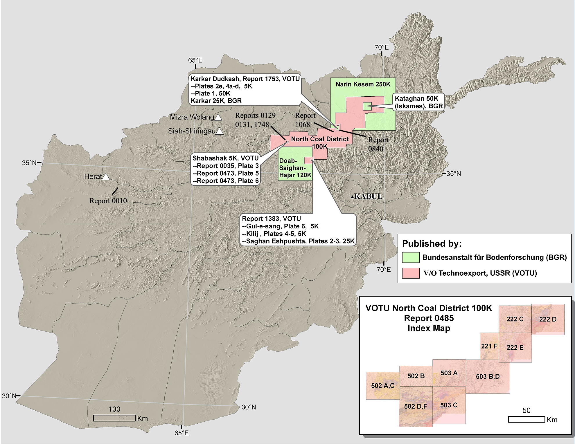
Most of the historical coal exploration is concentrated in north-central Afghanistan, a region referred to as the North Coal District, and almost all of the coal-related maps found Afghanistan Geological Survey (AGS) archives to date cover various locations within that district as shown in the index map. Most of the maps included herein were originally scanned during U.S. Geological Survey (USGS) site visits to Kabul in November 2004 and February 2006. The scanning was performed using equipment purchased by U.S. Agency for International Development (USAID) and U.S. Trade and Development Agency (USTDA) and installed at the AGS by USGS. Many of these maps and associated reports exist as single unpublished copies in the AGS archives, so these efforts served not only to provide a basis for digital capturing, but also as a means for preserving these rare geologic maps and reports. The data included herein represent most of the coal-related reports and maps that are available in the AGS archives. This report excludes the limited cases when a significant portion of a reports text could not be located, but it does not exclude reports with missing plates.
The vector files are released using the Environmental Systems Research Institute (ESRI) Personal Geodatabase, ESRI shapefile vector format, and the open Geography Markup Language (GML) format. Scanned images are available in JPEG and, when rectified, GeoTIFF format.
The authors wish to acknowledge the contributions made by the staff of the AGS Records and Coal Departments whose valuable assistance made it possible to locate and catalogue the data provided herein. We especially acknowledge the efforts of particular members of the coal team: Engineer Saifuddin Aminy (Team Leader); Engineer Gul Pacha Azizi; Engineer Abdul Haq Barakati; Engineer Abdul Basir; Engineer Mohammad Daoud; Engineer Abdullah Ebadi; Engineer Abdul Ahad Omaid; Engineer Spozmy; and Engineer Shapary Tokhi. The ongoing efforts of Engineer Mir M. Atiq Kazimi (Team leader); Engineer M. Anwar Housinzada; and Engineer Shereen Agha of the AGS Records Department to organize and catalogue the AGS material were invaluable in locating and preserving these data. The efforts of the entire AGS staff to personally preserve these data during war time, in the absence of virtually any supporting infrastructure, was truly remarkable. The efforts by the British Geological Survey (BGS) to assist the AGS in archiving these data, and the personal assistance provided by BGS (notably Robert McIntosh), to the USGS teams were also appreciated. The logistical support provided by the U.S. Embassy in Kabul, particularly the Afghanistan Reconstruction Group, was critical to the success of the USGS teams while in Afghanistan. Finally, the efforts of the Minister of the Ministry of Mines and Industries (M. Ibrahim Adel) to support the USGS coal resource assessment in Afghanistan, in both his current and former role as President of the Mines Affairs Department was vital to this effort.
Read this report as a PDF file (LARGE-SCALE_MAPS_REPORT.PDF; 2 MB)
COAL_GIS_MAPS
The GIS package is a large .zip arcive file that contains the following two sets of data (plus an index-map folder with shapefile and hillshade information). The contents and examples are excerpted below. Besides geology, many of the areas have other types of data such as bed dip angle, seams, structure, and contacts.
COAL_REPORTS (open this directory)
INDEX_MAP
SOFTWARE
For questions about the digital content of this report, contact Trent Hare or Philip Davis.
For general information on the coal resources of Afghanistan, contact John SanFilipo.
Suggested citation and version history
This report is for sale as a single dual-layer DVD–ROM:
U.S. Geological Survey
Information Services, USGS
Box 25286
Denver Federal Center
Denver, CO 80225
Telephone: (888) ASK-USGS; email: infoservices@usgs.gov
ISBN: 978-1-4113-2269-1
Current pricing information is available from http://ask.usgs.gov/to_order.html.
Download a free copy of the current version of Adobe Reader.
| Help
| PDF help
| Publications main page | Geologic
Division |
| Mineral Resources Program
| Energy Resources Program
| Astrogeology Research Program
|

![]() U.S. Department of the Interior | U.S. Geological Survey
U.S. Department of the Interior | U.S. Geological Survey
URL: https://pubs.usgs.gov/ds/317
Page Contact Information: Michael Diggles
Page Created: September 17, 2008
Page Last Modified: October 3, 2008
(mfd)
