U.S. Geological Survey Data Series 651
Click on a segment name to view the contact sheet.
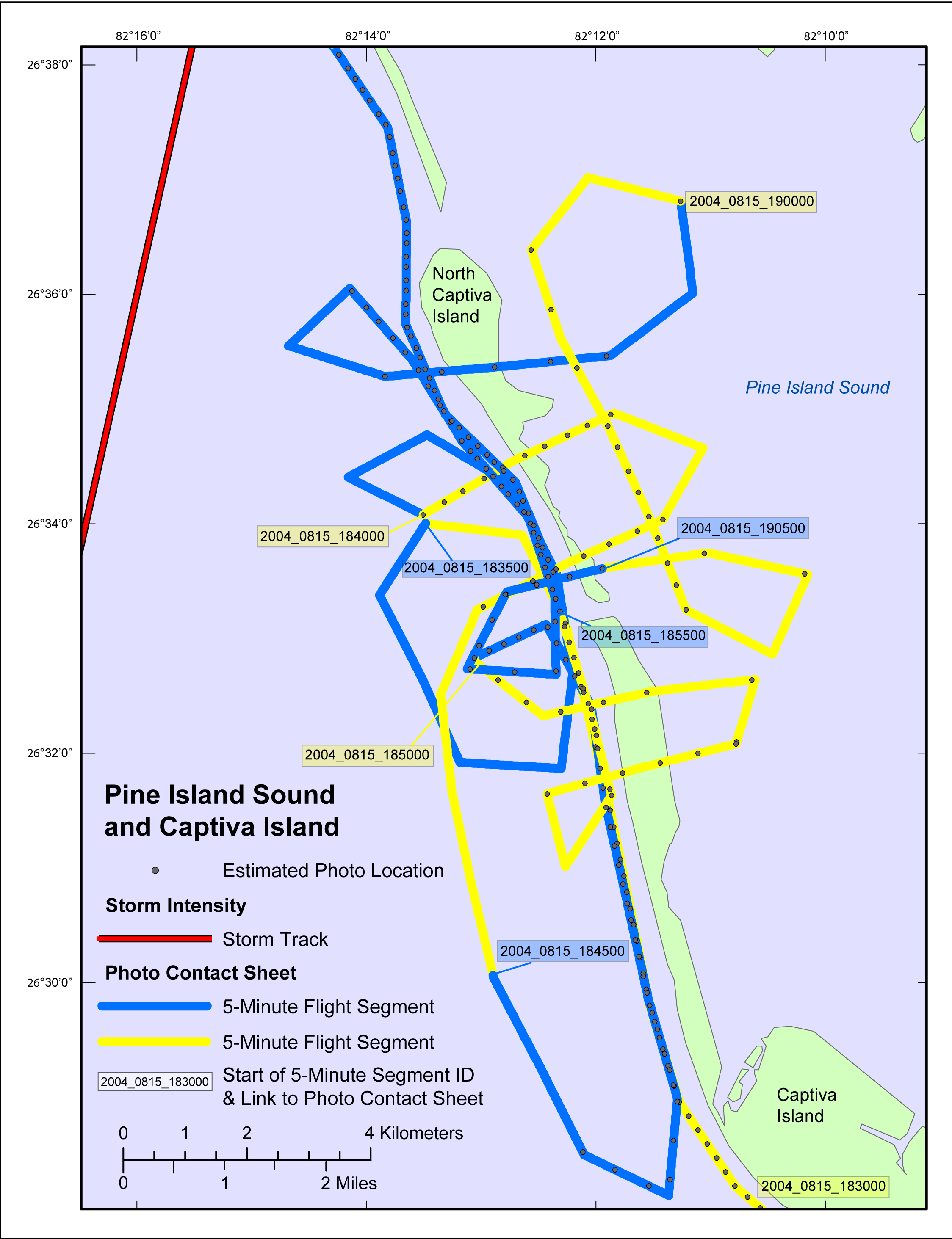
| Figure 5. Map showing the post-Hurricane Charley flight path in the Pine Island Sound and Captiva Island location of the study area. Blue and yellow colored sections of the flight path correspond to 5-min flight segments that link to a contact sheet of associated photo thumbnails. Gray dots show the estimated location of where the photograph was taken. Red line shows the storm track. NOTE: There are no slides, and therefore will be no contact sheet, corresponding to segment 2004_0815_183500. NOTE: Links to the contact sheets are available on both discs of the DVD version of this report, but links to full-size photographs will work only if viewing from Disc 2 (Internet version unaffected). |

![]() U.S. Department of the Interior |
U.S. Geological Survey
U.S. Department of the Interior |
U.S. Geological Survey
URL: http://pubsdata.usgs.gov/pubs/ds/651/html/pineisl.html
Page Contact Information: GS Pubs Web Contact
Page Last Modified: Monday, 28-Nov-2016 18:41:20 EST
