U.S. Geological Survey Data Series 652
| Item | Details | Trackline Map - UTM Zone 17 |
|---|---|---|
| Minimum Northing Minimum Latitude |
3132722.8 28 19.1937' N |
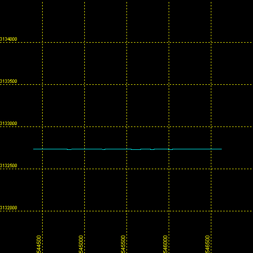 |
| Maximum Northing Maximum Latitude |
3132740.7 28 19.1987' N |
|
| Minimum Easting Minimum Longitude |
544383.7 080 32.8349' W |
|
| Maximum Easting Maximum Longitude |
546625.5 080 31.4628' W |

![]() U.S. Department of the Interior |
U.S. Geological Survey
U.S. Department of the Interior |
U.S. Geological Survey
URL: http://pubsdata.usgs.gov/pubs/ds/652/maps/linenav/96fgs01/sb_b14b_nav.html
Page Contact Information: GS Pubs Web Contact
Page Last Modified: Monday, 28-Nov-2016 18:53:03 EST
