U.S. Geological Survey Data Series 652
Cruise 96FGS01 - Boomer Line sb_b20 Navigation Map
Item
Details
Trackline Map - UTM Zone 17
Minimum Northing
Minimum Latitude3127719.7
28 16.4741' N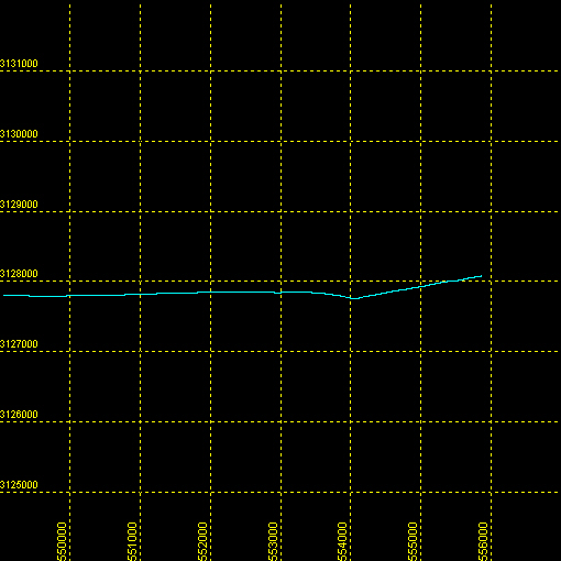
Maximum Northing
Maximum Latitude3128079.3
28 16.6525' N
Minimum Easting
Minimum Longitude549018.2
080 30.0111' W
Maximum Easting
Maximum Longitude555870.1
080 25.8183' W
![]() U.S. Department of the Interior |
U.S. Geological Survey
U.S. Department of the Interior |
U.S. Geological Survey
URL: http://pubsdata.usgs.gov/pubs/ds/652/maps/linenav/96fgs01/sb_b20_nav.html
Page Contact Information: GS Pubs Web Contact
Page Last Modified: Monday, 28-Nov-2016 18:53:07 EST
