U.S. Geological Survey Data Series 652
| Item | Details | Trackline Map - UTM Zone 17 |
|---|---|---|
| Minimum Northing Minimum Latitude |
3091755.7 27 56.9788' N |
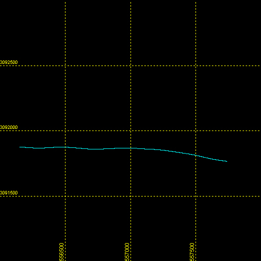 |
| Maximum Northing Maximum Latitude |
3091879.8 27 57.0419' N |
|
| Minimum Easting Minimum Longitude |
556145.0 080 25.7544' W |
|
| Maximum Easting Maximum Longitude |
557739.6 080 24.7815' W |

![]() U.S. Department of the Interior |
U.S. Geological Survey
U.S. Department of the Interior |
U.S. Geological Survey
URL: http://pubsdata.usgs.gov/pubs/ds/652/maps/linenav/97fgs01/sb_b66_b_nav.html
Page Contact Information: GS Pubs Web Contact
Page Last Modified: Monday, 28-Nov-2016 18:54:56 EST
