U.S. Geological Survey Data Series 652
| Item | Details | Trackline Map - UTM Zone 17 |
|---|---|---|
| Minimum Northing Minimum Latitude |
3133322.0 28 19.4912' N |
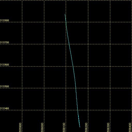 |
| Maximum Northing Maximum Latitude |
3133837.1 28 19.7700' N |
|
| Minimum Easting Minimum Longitude |
556096.4 080 25.6647' W |
|
| Maximum Easting Maximum Longitude |
556160.4 080 25.6240' W |

![]() U.S. Department of the Interior |
U.S. Geological Survey
U.S. Department of the Interior |
U.S. Geological Survey
URL: http://pubsdata.usgs.gov/pubs/ds/652/maps/linenav/97fgs01/t1_sb_nav.html
Page Contact Information: GS Pubs Web Contact
Page Last Modified: Monday, 28-Nov-2016 18:55:17 EST
