
Bathymetry and Acoustic Backscatter: Eastern Santa Barbara Channel, California
Maps
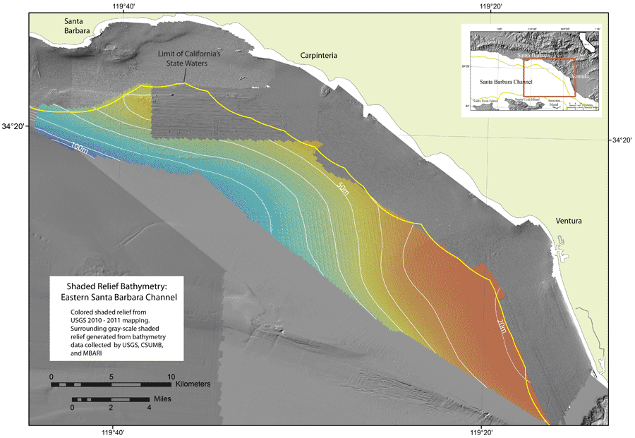 |
| Shaded relief bathymetry of the eastern Santa Barbara Channel region. The colored shaded relief is from the 2010 and 2011 USGS mapping. The gray-scale shaded relief is generated from bathymetry data collected by the USGS, CSUMB, and MBARI. |
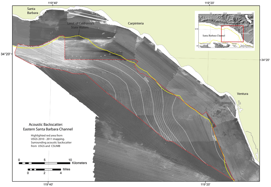 |
| Acoustic backscatter imagery of the eastern Santa Barbara Channel region. The red highlighted region is from the 2010 and 2011 USGS mapping. The surrounding backscatter imagery is from data collected by the USGS and CSUMB. |
For more information contact: Peter Dartnell
