Data Series 935
|
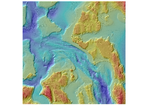
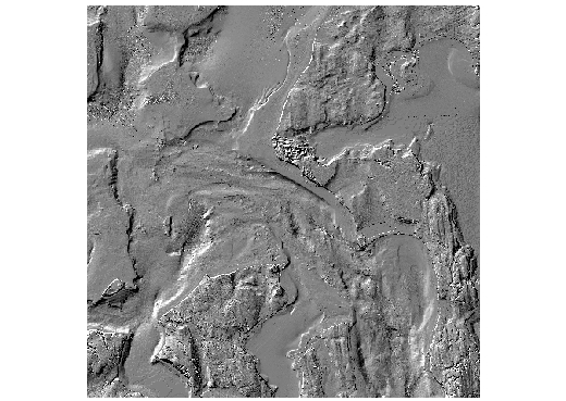
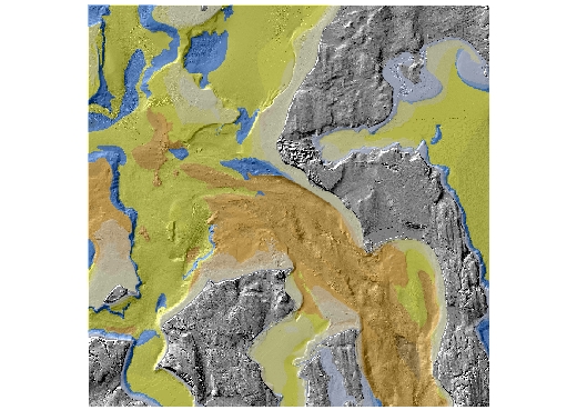
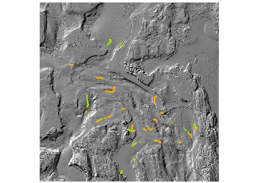
Maps that show these data are published in Open File Report 2015-1073, "Southern Salish Sea Habitat Map Series--Admiralty Inlet." Each GIS data file for the Admiralty Inlet map area is listed below with a brief description, a small image, and links to the metadata files and the downloadable data files. The data were compiled in ArcMap (version 10.1, Esri, 2012). Raster data layers are registered TIFF images and are in the UTM Zone 10N coordinate system, with North American Datum of 1983 (NAD83). Point, line, and polygon features are in shapefile format and are projected in UTM Zone 10N coordinates, with horizontal datum NAD83. Attributes in the shapefiles are described in the metadata files. We recommend that you create a single new folder within which to unzip the files you want to use. The downloadable data files have been compressed with the "zip" command, and can be unzipped with Winzip (or other tool) on Windows systems. The .zip file for a TIFF image includes the image (.tif), the world registration file (.tfw), and the text (.txt) and XML (.tif.xml) versions of the metadata. The .zip for a shapefile includes the .aux, .dbf, .shp, .shx, .sbx, and .sbn files, as well as the text (.txt) and XML (.shp.xml) versions of the metadata. ArcGIS Project FileAdmiraltyInletGIS.mxd.zip (0.1 MB) is a compressed (with the "zip" command) version of the ArcMap document (.mxd) that has all the data layers loaded in the table of contents and has all the data symbolized as on the SIM map sheets. Download and save this ArcGIS project file, including all data layers, to the directory you created for this GIS. GIS Data FilesDate last modified, August 8, 2013
|
First posted June 2, 2015
For additional information, contact: |

![]() U.S. Department of the Interior |
U.S. Geological Survey
U.S. Department of the Interior |
U.S. Geological Survey
URL: http://pubsdata.usgs.gov/pubs/ds/935/downloads/AdmiraltyInlet/ds935_AdmiraltyInlet.html
Page Contact Information: GS Pubs Web Contact
Page Last Modified: Monday, 28-Nov-2016 20:36:38 EST