| USGS | BACK Page 1 |
NEXT Page 2 |
Index Page | Geology | Search USGS |
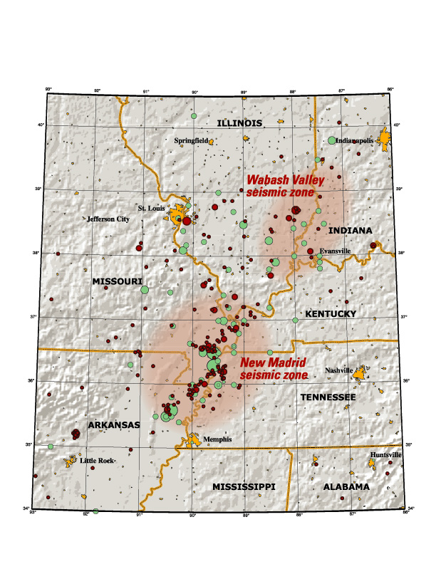
This map of the New Madrid and Wabash Valley seismic zones shows earthquakes as circles. Red circles indicate earthquakes that occurred from 1974 to 2002 with magnitudes larger than 2.5 located using modern instruments (University of Memphis). Green circles denote earthquakes that occurred prior to 1974 (USGS Professional Paper 1527). Larger earthquakes are represented by larger circles.
| USGS | BACK Page 1 |
NEXT Page 2 |
Index Page | Geology | Search USGS |