|
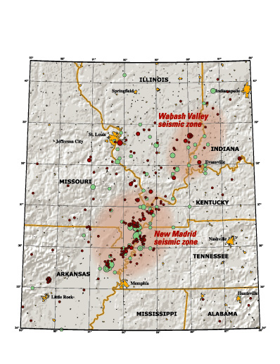
Evidence that earthquakes threaten the Mississippi, Ohio, and Wabash River
valleys of the Central United States abounds. In fact, one of the
largest historical earthquakes to strike the continental United
States occurred in the winter of 1811-1812 along the New Madrid
seismic zone, which stretches from just west of Memphis, Tennessee,
into southern Illinois. Several times in the past century, moderate
earthquakes have been widely felt in southern Illinois and southwestern
Indiana. Geologic evidence for prehistoric earthquakes throughout
the region has been mounting since the late 1970s. But how significant
is the threat? How likely are large earthquakes and, more importantly,
what is the chance that the shaking they cause will be damaging?
Like many natural phenomena, how an earthquake affects people depends on many factors. Studying earthquakes is especially challenging because they happen infrequently
and withoutany advanced warning. Also, the processes that cause earthquakes work over many thousands of years and deep beneath the Earths surface. Nonetheless, research
during the last 15 years has led to new understanding, particularly with respect to earthquakes in the New Madrid seismic zone. Not surprisingly, as the understanding
of earthquakes evolves, so do the estimates of the hazard that they pose. |