Georiga Water Science Center
U.S. Geological Survey General Interest Publication 4
 The lower Flint River subbasin is
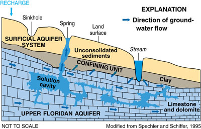
characterized by karst topography in which sinkholes, caves, and underground drainage have formed because of dissolution of
limestone comprising the Upper Floridan aquifer. Lack of tributaries and little surface-water drainage between Albany and
Lake Seminole indicates under-ground drainage;
most surface water either flows into wetlands and then seeps into the ground, or infiltrates directly into the ground.
 |
  |
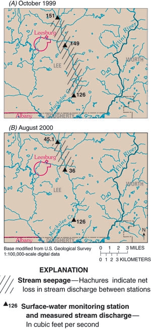
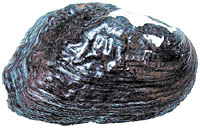
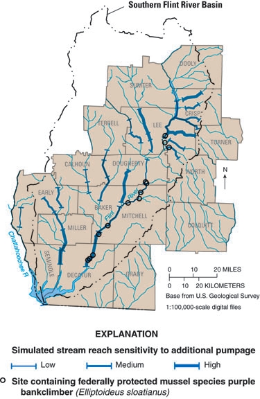
| Stream seepage along Muckalee Creek near Leesburg, Georgia, (A) October 1999 and (B) August 2000. The Upper Floridan aquifer typically discharges water to stream channels, which constitutes the majority of baseflow. Drought conditions typically decrease both runoff and ground-water discharge to streams. These decreases, from May 1998 through August 2000, resulted in record or near-record low streamflows occurred throughout the subbasins (Mosner, 2002). | A ground-water model was used to simulate stream reach sensitivity to ground-water pumpage for sites containing federally protected mussel species such as the purple bankclimber (Elliptoideus sloatianus) in the lower Apalachicola–Chattahoochee–Flint River Basin (Albertson and Torak, 2002). |
Recent USGS publications on Georgia or Georgia Water-Resources Information
For more information, please contact webmaster-ga@usgs.gov.