larger version (118 kb)
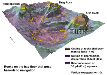
Three rock pinnacles--Harding, Shag, and Arch on the floor of west-central San Francisco Bay--lie adjacent to the navigation lanes and rise to potentially hazardous elevations for shipping traffic. The shallowest parts are outlined in yellow. Nearby depressions are outlined in orange.
|

Hypothetical Remedy for a Threat to Navigation
larger version (32 kb)
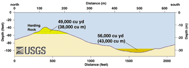
This is a cross-section through Harding Rock and an adjacent depression. The volume calculations show that the graded material would fit in the adjacent hole. This is merely a geometric exercise and no such solution or option should be undertaken without extensive studies of environmental and other impacts.
|

larger version (111 kb)
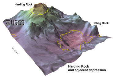
The peak of Harding Rock is 36 feet (11 meters) below sea level. The vertical exaggeration is 10x. The gray mesh is 150 x 150 feet (46 meters).
|

larger version (110 kb)
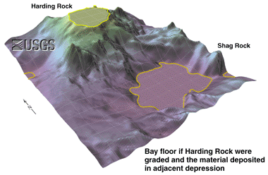
This is a view of Harding Rock if it were graded to 55 feet (17 meters). The vertical exaggeration is 10x. The gray mesh is 150 x 150 feet (46 x 46 meters).
|