|
Sidescan-Sonar Imagery of the Shoreface and Inner Continental Shelf, Wrightsville Beach, North Carolina
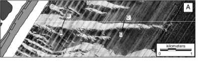
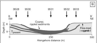
Figure 7.
Map and cross-section across the large rippled scour depression shown in Figure 1.
A: The rippled scour depressions on the Wrightsville Beach shoreface are up to 1 m deep, and are floored by coarse shell hash, sand and gravel. As shown here, as well as in Figures 1 and Figure 6 , the northern edges (contacts between coarse and fine sediments) of the rippled scour depressions are sharp. The southern contacts, however, appear more ragged or "wisply."
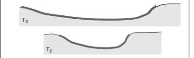
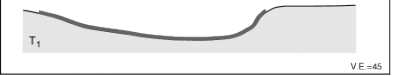
B: A schematic diagram showing the changes in rippled scour depression width through time (T1, T2, T3, Tpresent) suggested by the course-fine sediment stratigraphy in the cores shown in Figure 8.
Click on figures to zoom in
|