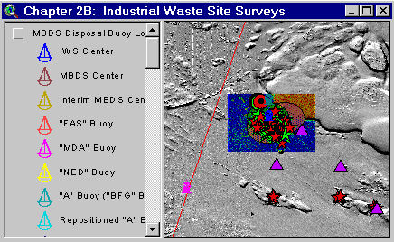
Sample from the ArcView window for Chapter 2B
Chapter 2B: The 1990’s Industrial Waste Site (IWS) Surveys
Return to TABLE OF CONTENTS
Continue to CHAPTER 2C
| To view all the coverages described in this Chapter, open the view titled Chapter 2B while running the ArcView project (mbay_30.apr or mbay_31.apr) in the mbaygis directory of this CD-ROM. To view summary metadata (file names, descriptions, provider, references) see the table below. To view complete metadata, go to directory "9_biblio" on this CD-ROM and open the file metadata.mdb using Microsoft Access or the file Gismeta.htm using your browser. |
Sample from the ArcView window for Chapter 2B |
The 1981-1982 survey of Massachusetts Bay radioactive waste sites (see Chapter 2A) concluded that radionuclide contamination in Massachusetts Bay fell within or below background concentrations. Therefore, the past disposal of 4,008 containers with low level radioactive waste (LLW) in the bay did not appear to pose a threat to seafood safety or the marine environment. But in the 1990’s, public and Congressional concern about the adequacy of the earlier investigations led to a growing need for more information (NOAA, 1996). Consequently, several investigations refocused efforts on historic radioactive waste disposal in Massachusetts Bay. In addition some of the investigations included fate and effects examinations of historic industrial chemical waste. One of the primary sites re-examined was the 1980-81 Area 1, which was the Industrial Waste Site (IWS).
Industrial Waste Site (IWS) 1991
This survey led by the International Wildlife Coalition (IWC), with funding support from the EPA, searched the IWS with a remotely operated vehicle (ROV) for waste containers. The results of this investigation concluded that potentially several tens of thousands of waste barrels littered the sea floor in and about the IWS, and that an evaluation of seafood safety and threat to the marine environment was warranted (Wiley and others, 1992).
The IWC strategy involved deployment of the ROV from various anchorage points using alpha designations (i.e. A, B, C, etc.). Records of targets, including waste barrels and other objects, were logged during the survey along with fixes (latitude/longitude coordinates) of their location.
Some coverages in Chapter 2B relating to the 1991 IWS surveys include:
IWS 1992
This investigation was an outgrowth of the IWC survey in 1991 (Wiley and others, 1992). The investigation focused on barrel targets in the vicinity of the IWS, but some limited inspections involved the former Boston Lightship area (NOAA, 1996). The survey requirements depended upon the Harbor Branch Oceanographic Institution’s (HBOI’s) submersible Johnson Sea Link-II (JSL-II) to gather sediment samples for chemical analysis at individual targets, and then to interrogate the barrel and contents with a US Department of Energy underwater gamma spectrometer (NOAA, 1996). A NOAA National Underwater Research Center for the North Atlantic and Great Lakes (NURC NA&GL) remotely operated vehicle (Phantom S2) conducted target search operations off of the NOAA research vessel (R/V) Gloria Michel. Seafood safety samples of groundfish and lobsters were collected with traps and otter trawls for an assessment by the U.S. Food and Drug Administration (FDA); the data from this portion of the investigation will be included in a future version of this CD-ROM.
Some coverages in Chapter 2B relating to the 1992 IWS surveys include:
The former BLS and IWS 1993
The survey sponsored by ACOE involved towing an analog Laser Linescan System (LLSS) operated by Science Applications International Corporation (SAIC, 1993a).
Some coverages in Chapter 2b relating to the 1993 IWS surveys include:
The former BLS, IWS, and Massachusetts Water Resources Authority (MWRA) Outfall 1997
NOAA and EPA began this survey with a focus on the former BLS disposal area and with the intention of locating radioactive waste containers. Potential targets were identified from an interpretation (EPA, 1997) of sidescan sonar records taken in 1991 (Keith and others, 1992). Potential target location first relied on surface positioning with the Harbor Branch Oceanographic Institution’s (HBOI) R/V Sea Diver. Once in the vicinity of a potential target or target cluster, the Sea Diver deployed the HBOI submersible Clelia (Perry Model PC-1204) or a NOAA/ NURC NA&GL Phantom S2 ROV. Both the submersible and ROV relied on sector scanning sonar and forward looking sonar to locate potential targets once near the sea floor. The Clelia was outfitted with a Raytheon Electronic Services (RES) digital fluorescing laser line scan system (FILLS), that was to validate target identification and provide views of the sea floor environment. Laser image snapshots processed on board the Sea Diver by RES and the U.S. Navy Coastal Systems Station enabled NOAA and EPA to make critical decisions regarding the direction of search efforts. The ROV configured with a HI-8 mm video recording camera provided additional imagery of the sea floor environment and potential targets. The ROV was also outfitted with a US Department of Energy underwater gamma spectrometer to interrogate radioactivity potential at suspect targets. All potential targets searched in the BLS based upon the sidescan sonar interpretation did not reveal themselves as targets of concern (Lindsay and others, 1998). During field operations, a decision was made to apply the FILLS and ROV to the IWS, an area of known potential targets. Only a single dive with the Clelia and the ROV were possible due to a deterioration in sea state, however containers were observed with both vehicles (Lindsay and others, 1998), although none demonstrated radioactivity. As noted above, the survey began with a focus on the BLS, but it expanded through collateral partnerships with the ACOE and the MWRA. Only the IWS coverages are included in this subchapter (see Chapters 2C and 3 for the BLS and MWRA coverages, respectively).
Some coverages in Chapter 2B relating to 1997 surveys include:
Clelia dive 483 records, including fixes and FILLS snapshot locations.
ROV dive taken on 28 September 1997
Coverages provided in chapter 2B: (Summary metadata for files in the Chapter 2B view are listed alphabetically in the table below. For complete metadata, go to directory "9_biblio" on this CD-ROM and open the file metadata.mdb using Microsoft Access or the file Gismeta.htm using your browser.)
| File Name | Layer Content | Published reference | E-mail of Contact Person | Agency/Organization |
|---|---|---|---|---|
| 1985ss.shp | Sidescan tracks from Mass Bay Disposal Site Survey | seidelc@mtg.saic.com | SAIC | |
| 1mingrid.shp | One Minute Latitute/Longitude Grid | wwwnurc@uconnvm.uconn.edu | NOAA/NURC | |
| 3mile.shp | 3 Mile Boundary line off the coast of Mass | seidelc@mtg.saic.com | SAIC | |
| 404water.shp | 404 Boundary Waters off the coast of Mass | seidelc@mtg.saic.com | SAIC | |
| 482cle.shp | Location of Navigation System Positions Associated with Clelia Submersible Dive 482 of the 1997 Massachusetts Bay radioactive waste survey. | wwwnurc@uconnvm.uconn.edu | NOAA/NURC | |
| 482lls.shp | Location of Laser Line Scan Images Associated with Clelia Submersible Dive 482 of the 1997 Massachusetts Bay Radioactive Waste Survey | wwwnurc@uconnvm.uconn.edu | NOAA/NURC | |
| 483cle.shp | Raw navigation fixes from 1997 Clelia dive 483 | wwwnurc@uconnvm.uconn.edu | NOAA/NURC | |
| 483lls.shp | Laser line scan sites from 1997 Clelia dive 483 | wwwnurc@uconnvm.uconn.edu | NOAA/NURC | |
| 485cle.shp | Raw navigation fixes from 1997 Clelia dive 485 | wwwnurc@uconnvm.uconn.edu | NOAA/NURC | |
| 485lls.shp | Laser line scan sites from 1997 Clelia dive 485 | wwwnurc@uconnvm.uconn.edu | NOAA/NURC | |
| 5mingrid.shp | Five Minute Latitute/Longitude Grid | wwwnurc@uconnvm.uconn.edu | NOAA/NURC | |
| 928_1ps2.shp | Location of Navigation System Positions Associated with Phantom S2 dive #928_1 of the 1997 Massachusetts Bay radioactive waste survey | wwwnurc@uconnvm.uconn.edu | NOAA/NURC | |
| 928_1ss.shp | Location of Example Sector Scanning Sonar Imagery Associated with Phantom S2 dive #928_1 of the 1997 Massachusetts Bay Radioactive Waste Survey | wwwnurc@uconnvm.uconn.edu | NOAA/NURC | |
| 928_1vdo.shp | Location of Digital Video Clips Associated with Phantom S2 dive #928_1 of the 1997 Massachusetts Bay Radioactive Waste Survey. | wwwnurc@uconnvm.uconn.edu | NOAA/NURC | |
| bathy5mb.shp | 5-meter bathymetric contour lines for Western Mass Bay (Quads 19-21) | Butman, B., W. W. Danforth and L. Hayes, Sea Floor Topography and Backscatter of Quadrangles 19-21, Western Massachusetts Bay, Off Boston, Massachusetts, USGS Open-File Report (in prep.) | bbutman@usgs.gov, lhayes@usgs.gov | USGS |
| bathy5sb.shp | 5-meter bathymetric contour lines for Stellwagen Bank (Quads 1-18) | Valentine, P., J. Baker, T. Unger, C. Polloni, 1998, Sea Floor Topographic Map and Perspective-View Imagery of Quadrangles 1-18, Stellwagen Bank National Marine Sanctuary off Boston, Massachusetts, USGS Open-File Report 98-138. | pvalentine@usgs.gov; lhayes@usgs.gov | USGS |
| Buoys_dd.shp | Locations of NOAA Weather Buoys | liebman.matt@epamail.epa.gov | EPA | |
| dsites.shp | Massachusetts Bay Dredge Material and Interim dredge material disposal sites | EPA Reported locations | john.lindsay@noaa.gov | NOAA/EPA |
| dump_psd | Pseudocolor/Shaded Relief image (ARC/INFO grid) of MassBay disposal site (see description) | Valentine, Baker, Unger, Evans, and Polloni, 1998, U.S. Geological Survey Open-File Report 98-344. 1 CD-ROM. Sea Floor Topographic, Backscatter, and Interpretive Maps and Bottom Photos of the Massachusetts Bay Disposal Site region off Boston, MA. | pvalentine@usgs.gov, lhayes@usgs.gov | USGS |
| dump_ss | Backscatter image (ARC/INFO grid) of MassBay disposal site | Valentine, Baker, Unger, Evans, and Polloni, 1998, U.S. Geological Survey Open-File Report 98-344. 1 CD-ROM. Sea Floor Topographic, Backscatter, and Interpretive Maps and Bottom Photos of the Massachusetts Bay Disposal Site region off Boston, MA. | pvalentine@usgs.gov, lhayes@usgs.gov | USGS |
| dump_sun | Shaded Relief image (ARC/INFO grid) of MassBay disposal site | Valentine, Baker, Unger, Evans, and Polloni, 1998, U.S. Geological Survey Open-File Report 98-344. 1 CD-ROM. Sea Floor Topographic, Backscatter, and Interpretive Maps and Bottom Photos of the Massachusetts Bay Disposal Site region off Boston, MA. | pvalentine@usgs.gov, lhayes@usgs.gov | USGS |
| Epass96.shp | Location of sidescan track lines from 1996 | wwwnurc@uconnvm.uconn.edu | NOAA/NURC | |
| fads88.shp | Contour lines from 1988 Survey | SAIC Contribution 79: Valente and Walton, April 1989, Seasonal Monitoring Cruise at the Foul Area Disposal Site, November 1988 - January 1989. | seidelc@mtg.saic.com | SAIC |
| iws_site.shp | Mass Bay IWS and SE Radioactive waste dump sites | Reported locations and NOS #13267, 28th Edition, 1.25.1997, digitally produced by Maptech, Inc. | john.lindsay@noaa.gov | NOAA/NOS/OR&R |
| Iws91.shp | ROV fixes from 1991 IWS survey | wwwnurc@uconnvm.uconn.edu | NOAA/NURC | |
| Jslinorg.shp | Inorganic chemistry values from JSL sediment samples | wwwnurc@uconnvm.uconn.edu | NOAA/NURC | |
| Jslorgan.shp | Organic chemistry values from JSL sediment samples | wwwnurc@uconnvm.uconn.edu | NOAA/NURC | |
| llssimg.shp | Laser Line Scan Image Locations | SAIC Report 294: M.Wiley, September 1993, Laser Linescan System (LLSS) Data Report April 1993. | seidelc@mtg.saic.com | SAIC |
| llssline.shp | Laser Line Scan Tracklines | SAIC Report 294: M.Wiley, September 1993, Laser Linescan System (LLSS) Data Report April 1993. | seidelc@mtg.saic.com | SAIC |
| llsspnt.shp | Laser Line Scan Navigational Points | SAIC Report 294: M.Wiley, September 1993, Laser Linescan System (LLSS) Data Report April 1993. | seidelc@mtg.saic.com | SAIC |
| mbds_pts.shp | Buoys and disposal area centerpoints for the greater Massachusetts Bay Disposal Site (including IWS) | Massachusetts Bay Disposal Site Management Plan dated December 31, 1996 | wwwnurc@uconnvm.uconn.edu | NURC |
| mbds_ref.shp | Mass Bay Disposal Site/Industrial Waste Site Reference Stations | EPA Reported locations, Massachusetts Bay Disposal Site Management Plan | liebman.matt@epamail.epa.gov, thomas.j.fredette@usace.army.mil | USEPA/Region 1 |
| mbds93p.shp | Polygon bathymetry from 1993 Survey | SAIC Report 317: E. DeAngelo & P. Murray, Baseline Survey of the Massachusetts Bay Disposal Site: Final Designation, 14 September 1993. | seidelc@mtg.saic.com | SAIC |
| mbds93ss.shp | Sidescan images from 1993 MBDS survey | SAIC Report 317: E. DeAngelo & P. Murray, Baseline Survey of the Massachusetts Bay Disposal Site: Final Designation, 14 September 1993. | seidelc@mtg.saic.com | SAIC |
| memanh.shp | Maine, Massachusetts, and New Hampshire state outlines | ESRI Data and Maps - 1996 | john.lindsay@noaa.gov | NOAA/USGS |
| misc_ne.shp | New England States | ESRI Data and Maps - 1996 | john.lindsay@noaa.gov | NOAA/USGS |
| prio_iws.shp | Prioritized targets from Sonar Contacts: IWS Survey | liebman.matt@epamail.epa.gov | IWS/EPA | |
| remots94.shp | REMOTS sediment profile stations (some with images) | P. Murray, December 1994, Monitoring Cruise at the Massachusetts Bay Disposal Site, August 1994 | seidelc@mtg.saic.com | SAIC |
| Rovfixes.shp | Navigation fixes from 1992 IWS ROV survey | wwwnurc@uconnvm.uconn.edu | NOAA/NURC | |
| Sbshd_ng.tif | Shaded Relief for Northern Stellwagen Bank, Geographic coordinates | Valentine, P., T. Unger, J. Baker, and C. Polloni, 1999, Sun-illuminated sea floor topographic maps and perspective-view imagery of Quadrangles 1-18, Stellwagen Bank National Marine Sanctuary off Boston, MA, U.S. Geological Survey Open-File Report 99-363. | pvalentine@usgs.gov | USGS |
| Sbshd_sg.tif | Shaded Relief for Southern Stellwagen Bank, Geographic coordinates | Valentine, P., T. Unger, J. Baker, and C. Polloni, 1999, Sun-illuminated sea floor topographic maps and perspective-view imagery of Quadrangles 1-18, Stellwagen Bank National Marine Sanctuary off Boston, MA, U.S. Geological Survey Open-File Report 99-363. | pvalentine@usgs.gov | USGS |
| wmbpsd_g | Pseudocolor image (ARC/INFO grid) Western Massachusetts Bay in Geographic coordinates (see description) | Butman, B., W. W. Danforth and L. Hayes, Sea Floor Topography and Backscatter of Quadrangles 19-21, Western Massachusetts Bay, Off Boston, Massachusetts, USGS Open-File Report (in prep.) | bbutman@usgs.gov, lhayes@usgs.gov | USGS |
| wmbshd_g | Shaded relief map of Western Massachusetts Bay in Geographic coordinates | Butman, B., W. W. Danforth and L. Hayes, Sea Floor Topography and Backscatter of Quadrangles 19-21, Western Massachusetts Bay, Off Boston, Massachusetts, USGS Open-File Report (in prep.) | bbutman@usgs.gov, lhayes@usgs.gov | USGS |
Return to TABLE OF CONTENTS
Continue to CHAPTER 2C
[an error occurred while processing this directive]