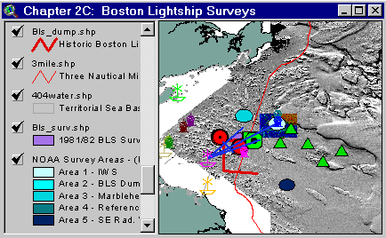
Sample from the ArcView window for Chapter 2C
Chapter 2C: Former Boston Lightship Dumping Ground Surveys
Return to TABLE OF CONTENTS
Continue to CHAPTER 2D
| To view all the coverages described in this Chapter, open the view titled Chapter 2C while running the ArcView project (mbay_30.apr or mbay_31.apr) in the mbaygis directory of this CD-ROM. To view summary metadata (file names, descriptions, provider, references) see the table below. To view complete metadata, go to directory "9_biblio" on this CD-ROM and open the file metadata.mdb using Microsoft Access or the file Gismeta.htm using your browser. |
Sample from the ArcView window for Chapter 2C |
The Boston Lightship Dumping Grounds Environment
Coverages include
BLS Dumping Ground Boundaries (see ArcView shapefiles BLS_.shp, Blsh_vec.shp), locations of buoys associated with permitted disposal practices (see ArcView shapefiles buoys_dd.shp), key lights (lighthouses and lightships) associated with site permits, bottom topography, and potential future survey areas.The former Boston Lightship (BLS) Dumping Grounds and Surrounding Areas 1991
The survey utilizing sidescan-sonar to locate potential radioactive waste containers covered an approximately 16 square mile area centered near the BLS buoy (Keith and others, 1992). The records from this survey were re-interpreted in 1997 to aid in pending in situ investigations of low level radioactive waste containers (EPA, 1997). The interpretation provided information on the location of numerous vessels discarded in the area and mounds from the approximately 3 million cubic yards of dredged material associated with an earlier Boston Harbor Dredging Project.
Some coverages include:
The former BLS and IWS 1993
The survey sponsored by ACOE involved towing an analog laser linescan system (LLSS) operated by Science Applications International Corporation (SAIC, 1993a).
Some coverages include:
The former BLS, IWS, and Massachusetts Water Resources Authority (MWRA) Outfall 1997
NOAA and EPA began this survey with a focus on the former BLS disposal area to try to locate radioactive waste containers. The survey was expanded to include the Industrial Waste Site (Chapter 2B), and the MWRA Outfall (Chapter 3). At the BLS, potential targets were identified from an interpretation (EPA, 1997) of sidescan-sonar records taken in 1991 (Keith et al., 1992). Potential target location first relied on surface positioning with the Harbor Branch Oceanographic Institution’s (HBOI) R/V Sea Diver. Once in the vicinity of a potential target or target cluster, the Sea Diver deployed the HBOI submersible Clelia (Perry Model PC-1204) or a NOAA/ NURC NA&GL Phantom S2 ROV. Both the submersible and ROV relied on sector scanning sonar and forward looking sonar to locate potential targets once near the sea floor. The Clelia was outfitted with a Raytheon Electronic Services (RES) digital fluorescing laser line scan system (FILLS), which was to validate target identification, and provide a view of the sea floor environment. Laser image snapshots processed on board the Sea Diver by RES and the U.S. Navy Coastal Systems Station enabled NOAA and EPA to make critical decisions regarding the direction of search efforts. The ROV configured with a HI-8 mm video recording camera provided additional imagery of the sea floor environment and potential targets. The ROV was also outfitted with a US Department of Energy underwater gamma spectrometer, to interrogate radioactivity potential at suspect targets. All potential targets searched in the BLS based upon the sidescan-sonar interpretation did not reveal themselves as targets of concern (Lindsay et al., 1998).
Some coverages in chapter 2C include:
Records for Clelia dives 475-481, including fixes and FILLS snapshot locations.
ROV dives taken on 26 and 27 September 1997:
Clicking on an individual point will bring up the information contained in the source table such as latitude, longitude, original data source and comments as appropriate. Selecting Table under the Theme menu will provide similar information for all of the points in the shapefile.
Spreadsheet providing chronology of investigations of disposal sites in Massachusetts Bay:
mbds_sum.xls
html version of MBDS_SUM
Spreadsheet comparing sediment quality at reference and regional stations at Massachusetts Bay Disposal Site:
html version of MBDSCH2
Coverages provided in Chapter 2C: (Summary metadata for files in the Chapter 2C view are listed alphabetically in the table below. For complete metadata, go to directory "9_biblio" on this CD-ROM and open the file metadata.mdb using Microsoft Access or the file Gismeta.htm using your browser.)
| File Name | Layer Content | Published reference | E-mail of Contact Person | Agency/Organization |
|---|---|---|---|---|
| 1mingrid.shp | One Minute Latitute/Longitude Grid | wwwnurc@uconnvm.uconn.edu | NOAA/NURC | |
| 3mile.shp | 3 Mile Boundary line off the coast of Mass | seidelc@mtg.saic.com | SAIC | |
| 404water.shp | 404 Boundary Waters off the coast of Mass | seidelc@mtg.saic.com | SAIC | |
| 475cle.shp | Location of Navigation System Positions Associated with Clelia Submersible Dive 475 of the 1997 Massachusetts Bay radioactive waste survey. | wwwnurc@uconnvm.uconn.edu | NOAA/NURC | |
| 475lls.shp | Location of Laser Line Scan Images Associated with Clelia Submersible Dive 475 of the 1997 Massachusetts Bay Radioactive Waste Survey. | wwwnurc@uconnvm.uconn.edu | NOAA/NURC | |
| 476cle.shp | Location of Navigation System Positions Associated with Clelia Submersible Dive 476 of the 1997 Massachusetts Bay radioactive waste survey | wwwnurc@uconnvm.uconn.edu | NOAA/NURC | |
| 476lls.shp | Location of Laser Line Scan Images Associated with Clelia Submersible Dive 476 of the 1997 Massachusetts Bay Radioactive Waste Survey | wwwnurc@uconnvm.uconn.edu | NOAA/NURC | |
| 477cle.shp | Location of Navigation System Positions Associated with Clelia Submersible Dive 477 of the 1997 Massachusetts Bay radioactive waste survey | wwwnurc@uconnvm.uconn.edu | NOAA/NURC | |
| 477lls.shp | Location of Laser Line Scan Images Associated with Clelia Submersible Dive 477 of the 1997 Massachusetts Bay Radioactive Waste Survey | wwwnurc@uconnvm.uconn.edu | NOAA/NURC | |
| 478cle.shp | Location of Navigation System Positions Associated with Clelia Submersible Dive 478 of the 1997 Massachusetts Bay radioactive waste survey. | wwwnurc@uconnvm.uconn.edu | NOAA/NURC | |
| 478lls.shp | Location of Laser Line Scan Images Associated with Clelia Submersible Dive 478 of the 1997 Massachusetts Bay Radioactive Waste Survey. | wwwnurc@uconnvm.uconn.edu | NOAA/NURC | |
| 479cle.shp | Location of Navigation System Positions Associated with Clelia Submersible Dive 479 of the 1997 Massachusetts Bay radioactive waste survey | wwwnurc@uconnvm.uconn.edu | NOAA/NURC | |
| 479lls.shp | Location of Laser Line Scan Images Associated with Clelia Submersible Dive 479 of the 1997 Massachusetts Bay Radioactive Waste Survey. | wwwnurc@uconnvm.uconn.edu | NOAA/NURC | |
| 480cle.shp | Location of Navigation System Positions Associated with Clelia Submersible Dive 480 of the 1997 Massachusetts Bay radioactive waste survey | wwwnurc@uconnvm.uconn.edu | NOAA/NURC | |
| 480lls.shp | Location of Laser Line Scan Images Associated with Clelia Submersible Dive 480 of the 1997 Massachusetts Bay Radioactive Waste Survey. | wwwnurc@uconnvm.uconn.edu | NOAA/NURC | |
| 481cle.shp | Location of Navigation System Positions Associated with Clelia Submersible Dive 481 of the 1997 Massachusetts Bay radioactive waste survey | wwwnurc@uconnvm.uconn.edu | NOAA/NURC | |
| 481lls.shp | Location of Laser Line Scan Images Associated with Clelia Submersible Dive 481 of the 1997 Massachusetts Bay Radioactive Waste Survey. | wwwnurc@uconnvm.uconn.edu | NOAA/NURC | |
| 5mingrid.shp | Five Minute Latitute/Longitude Grid | wwwnurc@uconnvm.uconn.edu | NOAA/NURC | |
| 926_1ps2.shp | Location of Navigation System Positions Associated with Phantom S2 dive #926_1 of the 1997 Massachusetts Bay radioactive waste survey. | wwwnurc@uconnvm.uconn.edu | NOAA/NURC | |
| 926_1ss.shp | Location of Example Sector Scanning Sonar Imagery Associated with Phantom S2 dive #926_1 of the 1997 Massachusetts Bay Radioactive Waste Survey. | wwwnurc@uconnvm.uconn.edu | NOAA/NURC | |
| 926_1vdo.shp | Location of Digital Video Clips Associated with Phantom S2 dive #926_1 of the 1997 Massachusetts Bay Radioactive Waste Survey | wwwnurc@uconnvm.uconn.edu | NOAA/NURC | |
| 926_2ps2.shp | Location of Navigation System Positions Associated with Phantom S2 dive #926_2 of the 1997 Massachusetts Bay radioactive waste survey | wwwnurc@uconnvm.uconn.edu | NOAA/NURC | |
| 927_1ps2.shp | Location of Navigation System Positions Associated with Phantom S2 dive #927_1 of the 1997 Massachusetts Bay radioactive waste survey. | wwwnurc@uconnvm.uconn.edu | NOAA/NURC | |
| 927_1ss.shp | Location of Example Sector Scanning Sonar Imagery Associated with Phantom S2 dive #927_1 of the 1997 Massachusetts Bay Radioactive Waste Survey | wwwnurc@uconnvm.uconn.edu | NOAA/NURC | |
| 927_1vdo.shp | Location of Digital Video Clips Associated with Phantom S2 dive #927_1 of the 1997 Massachusetts Bay Radioactive Waste Survey. | wwwnurc@uconnvm.uconn.edu | NOAA/NURC | |
| bathy5mb.shp | 5-meter bathymetric contour lines for Western Mass Bay (Quads 19-21) | Butman, B., W. W. Danforth and L. Hayes, Sea Floor Topography and Backscatter of Quadrangles 19-21, Western Massachusetts Bay, Off Boston, Massachusetts, USGS Open-File Report (in prep.) | bbutman@usgs.gov, lhayes@usgs.gov | USGS |
| bathy5sb.shp | 5-meter bathymetric contour lines for Stellwagen Bank (Quads 1-18) | Valentine, P., J. Baker, T. Unger, C. Polloni, 1998, Sea Floor Topographic Map and Perspective-View Imagery of Quadrangles 1-18, Stellwagen Bank National Marine Sanctuary off Boston, Massachusetts, USGS Open-File Report 98-138. | pvalentine@usgs.gov; lhayes@usgs.gov | USGS |
| Bls_dump.shp | Historic Boston Light Ship Disposal Site | NOS #13009, 27th Edition, 8.7.1996, NOS #13267, 28th Edition, 1.25.1997 | john.lindsay@noaa.gov | NOAA/NOS/OR&R |
| bls_surv.shp | 1981-82 BLS Survey Area | |||
| blsh_vec.shp | Vectors indicating dump area | john.lindsay@noaa.gov | NOAA | |
| Buoys_dd.shp | Locations of NOAA Weather Buoys | liebman.matt@epamail.epa.gov | EPA | |
| dump_psd | Pseudocolor/Shaded Relief image (ARC/INFO grid) of MassBay disposal site (see description) | Valentine, Baker, Unger, Evans, and Polloni, 1998, U.S. Geological Survey Open-File Report 98-344. 1 CD-ROM. Sea Floor Topographic, Backscatter, and Interpretive Maps and Bottom Photos of the Massachusetts Bay Disposal Site region off Boston, MA. | pvalentine@usgs.gov, lhayes@usgs.gov | USGS |
| dump_ss | Backscatter image (ARC/INFO grid) of MassBay disposal site | Valentine, Baker, Unger, Evans, and Polloni, 1998, U.S. Geological Survey Open-File Report 98-344. 1 CD-ROM. Sea Floor Topographic, Backscatter, and Interpretive Maps and Bottom Photos of the Massachusetts Bay Disposal Site region off Boston, MA. | pvalentine@usgs.gov, lhayes@usgs.gov | USGS |
| dump_sun | Shaded Relief image (ARC/INFO grid) of MassBay disposal site | Valentine, Baker, Unger, Evans, and Polloni, 1998, U.S. Geological Survey Open-File Report 98-344. 1 CD-ROM. Sea Floor Topographic, Backscatter, and Interpretive Maps and Bottom Photos of the Massachusetts Bay Disposal Site region off Boston, MA. | pvalentine@usgs.gov, lhayes@usgs.gov | USGS |
| Fbld_geo.tif | 1997 Side Scan Mosaic of the Former BLD | matthias@coscan.com | Polaris Imaging | |
| Fbls_EPA.shp | Location of Former Boston Lightship from EPA report | john.lindsay@noaa.gov | NOAA/EPA | |
| Fbls_old.shp | Location of Former Boston Lightship | john.lindsay@noaa.gov | NOAA | |
| lights2.shp | Location of Light Houses in Mass Bay | john.lindsay@noaa.gov | NOAA | |
| mbds_ref.shp | Mass Bay Disposal Site/Industrial Waste Site Reference Stations | EPA Reported locations, Massachusetts Bay Disposal Site Management Plan | liebman.matt@epamail.epa.gov, thomas.j.fredette@usace.army.mil | USEPA/Region 1 |
| mbds_sum.xls | Summary data in an Excel spreadsheet table; Inventory of studies performed at MBDS | MBDS Site Management Plan | liebman.matt@epamail.epa.gov | EPA/ACOE |
| mbdsch2.htm | Sediment quality at reference and regional stations at Mass Bay Disposal Site | |||
| memanh.shp | Maine, Massachusetts, and New Hampshire state outlines | ESRI Data and Maps - 1996 | john.lindsay@noaa.gov | NOAA/USGS |
| misc_ne.shp | New England States | ESRI Data and Maps - 1996 | john.lindsay@noaa.gov | NOAA/USGS |
| Sbshd_ng.tif | Shaded Relief for Northern Stellwagen Bank, Geographic coordinates | Valentine, P., T. Unger, J. Baker, and C. Polloni, 1999, Sun-illuminated sea floor topographic maps and perspective-view imagery of Quadrangles 1-18, Stellwagen Bank National Marine Sanctuary off Boston, MA, U.S. Geological Survey Open-File Report 99-363. | pvalentine@usgs.gov | USGS |
| Sbshd_sg.tif | Shaded Relief for Southern Stellwagen Bank, Geographic coordinates | Valentine, P., T. Unger, J. Baker, and C. Polloni, 1999, Sun-illuminated sea floor topographic maps and perspective-view imagery of Quadrangles 1-18, Stellwagen Bank National Marine Sanctuary off Boston, MA, U.S. Geological Survey Open-File Report 99-363. | pvalentine@usgs.gov | USGS |
| shipwrck.shp | Mass Bay shipwreck locations | |||
| Sstarget.shp | Target locations from 1997 Side Scan Mosaic | matthias@coscan.com | Polaris Imaging | |
| wmbpsd_g | Pseudocolor image (ARC/INFO grid) Western Massachusetts Bay in Geographic coordinates (see description) | Butman, B., W. W. Danforth and L. Hayes, Sea Floor Topography and Backscatter of Quadrangles 19-21, Western Massachusetts Bay, Off Boston, Massachusetts, USGS Open-File Report (in prep.) | bbutman@usgs.gov, lhayes@usgs.gov | USGS |
| wmbshd_g | Shaded relief map of Western Massachusetts Bay in Geographic coordinates | Butman, B., W. W. Danforth and L. Hayes, Sea Floor Topography and Backscatter of Quadrangles 19-21, Western Massachusetts Bay, Off Boston, Massachusetts, USGS Open-File Report (in prep.) | bbutman@usgs.gov, lhayes@usgs.gov | USGS |
Return to TABLE OF CONTENTS
Continue to CHAPTER 2D
[an error occurred while processing this directive]