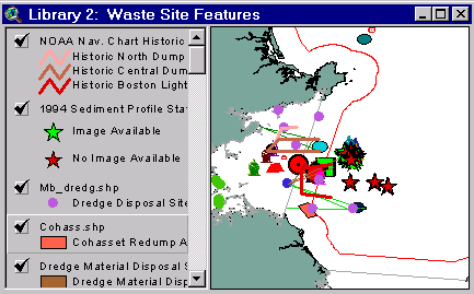
Sample from the ArcView window for Library 2
| Library 2: Waste Site Features |
Return to TABLE OF CONTENTS |
| To view all the coverages described in this Library, open the view titled Library 2 while running the ArcView project (mbay_30.apr or mbay_31.apr) in the mbaygis directory of this CD-ROM. To view summary metadata (file names, descriptions, provider, references) see the table below. To view complete metadata, go to directory "9_biblio" on this CD-ROM and open the file metadata.mdb using Microsoft Access or the file Gismeta.htm using your browser. |
Sample from the ArcView window for Library 2 |
For the Clelia dives, there are four files associated with each dive. For example, for Dive 475, there are shapefiles 475cle.shp (containing locations of submersible during dive), 475lls.shp (contains location of each laser line scan snapshot), 475vln.shp (containing the track line of the vessel supporting the Clelia dive), and 475wpt.shp (containing comments logged at a specific location during dive). For simplicity of this view, the shapefiles vln and wpt are not included in the view (although they are listed in the metadata tables as associated with this view. The files may be found in the 2_waste/bls Directory (for Clelia dives 475-481) and in Directory 2_waste Directory on the CD-ROM.
Coverages provided in Library 2: (Summary metadata for files in the Library 2 view are listed alphabetically in the table below. For complete metadata, go to directory "9_biblio" on this CD-ROM and open the file metadata.mdb using Microsoft Access or the file Gismeta.htm using your browser.)
| File Name | Layer Content | Published reference | E-mail of Contact Person | Agency/Organization |
|---|---|---|---|---|
| 475cle.shp | Location of Navigation System Positions Associated with Clelia Submersible Dive 475 of the 1997 Massachusetts Bay radioactive waste survey. | wwwnurc@uconnvm.uconn.edu | NOAA/NURC | |
| 475lls.shp | Location of Laser Line Scan Images Associated with Clelia Submersible Dive 475 of the 1997 Massachusetts Bay Radioactive Waste Survey. | wwwnurc@uconnvm.uconn.edu | NOAA/NURC | |
| 476cle.shp | Location of Navigation System Positions Associated with Clelia Submersible Dive 476 of the 1997 Massachusetts Bay radioactive waste survey | wwwnurc@uconnvm.uconn.edu | NOAA/NURC | |
| 476lls.shp | Location of Laser Line Scan Images Associated with Clelia Submersible Dive 476 of the 1997 Massachusetts Bay Radioactive Waste Survey | wwwnurc@uconnvm.uconn.edu | NOAA/NURC | |
| 477cle.shp | Location of Navigation System Positions Associated with Clelia Submersible Dive 477 of the 1997 Massachusetts Bay radioactive waste survey | wwwnurc@uconnvm.uconn.edu | NOAA/NURC | |
| 477lls.shp | Location of Laser Line Scan Images Associated with Clelia Submersible Dive 477 of the 1997 Massachusetts Bay Radioactive Waste Survey | wwwnurc@uconnvm.uconn.edu | NOAA/NURC | |
| 478cle.shp | Location of Navigation System Positions Associated with Clelia Submersible Dive 478 of the 1997 Massachusetts Bay radioactive waste survey. | wwwnurc@uconnvm.uconn.edu | NOAA/NURC | |
| 478lls.shp | Location of Laser Line Scan Images Associated with Clelia Submersible Dive 478 of the 1997 Massachusetts Bay Radioactive Waste Survey. | wwwnurc@uconnvm.uconn.edu | NOAA/NURC | |
| 479cle.shp | Location of Navigation System Positions Associated with Clelia Submersible Dive 479 of the 1997 Massachusetts Bay radioactive waste survey | wwwnurc@uconnvm.uconn.edu | NOAA/NURC | |
| 479lls.shp | Location of Laser Line Scan Images Associated with Clelia Submersible Dive 479 of the 1997 Massachusetts Bay Radioactive Waste Survey. | wwwnurc@uconnvm.uconn.edu | NOAA/NURC | |
| 480cle.shp | Location of Navigation System Positions Associated with Clelia Submersible Dive 480 of the 1997 Massachusetts Bay radioactive waste survey | wwwnurc@uconnvm.uconn.edu | NOAA/NURC | |
| 480lls.shp | Location of Laser Line Scan Images Associated with Clelia Submersible Dive 480 of the 1997 Massachusetts Bay Radioactive Waste Survey. | wwwnurc@uconnvm.uconn.edu | NOAA/NURC | |
| 481cle.shp | Location of Navigation System Positions Associated with Clelia Submersible Dive 481 of the 1997 Massachusetts Bay radioactive waste survey | wwwnurc@uconnvm.uconn.edu | NOAA/NURC | |
| 481lls.shp | Location of Laser Line Scan Images Associated with Clelia Submersible Dive 481 of the 1997 Massachusetts Bay Radioactive Waste Survey. | wwwnurc@uconnvm.uconn.edu | NOAA/NURC | |
| 482cle.shp | Location of Navigation System Positions Associated with Clelia Submersible Dive 482 of the 1997 Massachusetts Bay radioactive waste survey. | wwwnurc@uconnvm.uconn.edu | NOAA/NURC | |
| 482lls.shp | Location of Laser Line Scan Images Associated with Clelia Submersible Dive 482 of the 1997 Massachusetts Bay Radioactive Waste Survey | wwwnurc@uconnvm.uconn.edu | NOAA/NURC | |
| 483cle.shp | Raw navigation fixes from 1997 Clelia dive 483 | wwwnurc@uconnvm.uconn.edu | NOAA/NURC | |
| 483lls.shp | Laser line scan sites from 1997 Clelia dive 483 | wwwnurc@uconnvm.uconn.edu | NOAA/NURC | |
| 484cle.shp | Raw navigation fixes from 1997 Clelia dive 484 | wwwnurc@uconnvm.uconn.edu | NOAA/NURC | |
| 484lls.shp | Laser line scan sites from 1997 Clelia dive 484 | wwwnurc@uconnvm.uconn.edu | NOAA/NURC | |
| 485cle.shp | Raw navigation fixes from 1997 Clelia dive 485 | wwwnurc@uconnvm.uconn.edu | NOAA/NURC | |
| 485lls.shp | Laser line scan sites from 1997 Clelia dive 485 | wwwnurc@uconnvm.uconn.edu | NOAA/NURC | |
| 486cle.shp | Raw navigation fixes from 1997 Clelia dive 486 | wwwnurc@uconnvm.uconn.edu | NOAA/NURC | |
| 926_1ps2.shp | Location of Navigation System Positions Associated with Phantom S2 dive #926_1 of the 1997 Massachusetts Bay radioactive waste survey. | wwwnurc@uconnvm.uconn.edu | NOAA/NURC | |
| 926_1ss.shp | Location of Example Sector Scanning Sonar Imagery Associated with Phantom S2 dive #926_1 of the 1997 Massachusetts Bay Radioactive Waste Survey. | wwwnurc@uconnvm.uconn.edu | NOAA/NURC | |
| 926_1vdo.shp | Location of Digital Video Clips Associated with Phantom S2 dive #926_1 of the 1997 Massachusetts Bay Radioactive Waste Survey | wwwnurc@uconnvm.uconn.edu | NOAA/NURC | |
| 926_2ps2.shp | Location of Navigation System Positions Associated with Phantom S2 dive #926_2 of the 1997 Massachusetts Bay radioactive waste survey | wwwnurc@uconnvm.uconn.edu | NOAA/NURC | |
| 927_1ps2.shp | Location of Navigation System Positions Associated with Phantom S2 dive #927_1 of the 1997 Massachusetts Bay radioactive waste survey. | wwwnurc@uconnvm.uconn.edu | NOAA/NURC | |
| 927_1ss.shp | Location of Example Sector Scanning Sonar Imagery Associated with Phantom S2 dive #927_1 of the 1997 Massachusetts Bay Radioactive Waste Survey | wwwnurc@uconnvm.uconn.edu | NOAA/NURC | |
| 927_1vdo.shp | Location of Digital Video Clips Associated with Phantom S2 dive #927_1 of the 1997 Massachusetts Bay Radioactive Waste Survey. | wwwnurc@uconnvm.uconn.edu | NOAA/NURC | |
| 928_1ps2.shp | Location of Navigation System Positions Associated with Phantom S2 dive #928_1 of the 1997 Massachusetts Bay radioactive waste survey | wwwnurc@uconnvm.uconn.edu | NOAA/NURC | |
| 928_1ss.shp | Location of Example Sector Scanning Sonar Imagery Associated with Phantom S2 dive #928_1 of the 1997 Massachusetts Bay Radioactive Waste Survey | wwwnurc@uconnvm.uconn.edu | NOAA/NURC | |
| 928_1vdo.shp | Location of Digital Video Clips Associated with Phantom S2 dive #928_1 of the 1997 Massachusetts Bay Radioactive Waste Survey. | wwwnurc@uconnvm.uconn.edu | NOAA/NURC | |
| a3_otter.shp | Area 3 Otter trawl tow trackline | John.lindsay@noaa.gov | NOAA/EPA | |
| a4_otter.shp | Area 4 Otter trawl tow trackline | John.lindsay@noaa.gov | NOAA/EPA | |
| a4_rad.shp | Area 4 Radiation sampling | John.lindsay@noaa.gov | NOAA/EPA | |
| a5_otter.shp | Area 5 Otter trawl tow trackline | John.lindsay@noaa.gov | NOAA/EPA | |
| Area4.shp | NOAA Survey Area 4 | john.lindsay@noaa.gov | NOAA | |
| Area5.shp | NOAA Survey Area 5 | john.lindsay@noaa.gov | EPA/NOAA | |
| Bls_dump.shp | Historic Boston Light Ship Disposal Site | NOS #13009, 27th Edition, 8.7.1996, NOS #13267, 28th Edition, 1.25.1997 | john.lindsay@noaa.gov | NOAA/NOS/OR&R |
| bls_surv.shp | 1981-82 BLS Survey Area | |||
| blsh_vec.shp | Vectors indicating dump area | john.lindsay@noaa.gov | NOAA | |
| cohass.shp | Cohasset Redump Area | john.lindsay@noaa.gov | ||
| CSOS.shp | Boston Harbor CSO's | enquad@world.std.com, phastings@usgs.gov | MWRA | |
| dg_buf.shp | Dumping Ground | john.lindsay@noaa.gov | NOAA | |
| dg_buoy.shp | "Dumping Ground" Bell Buoy | john.lindsay@noaa.gov | NOAA | |
| dsites.shp | Massachusetts Bay Dredge Material and Interium dredge material disposal sites | EPA Reported locations | john.lindsay@noaa.gov | NOAA/EPA |
| dumpsite.shp | Areas used for IW, DM, and Munitions dumping | NOS #13009, 27th Edition, 8.7.1996 | john.lindsay@noaa.gov | NOAA/NOS |
| empirek.shp | Location M/V Empire Knight (Shipwreck) | john.lindsay@noaa.gov | ||
| Fbls_EPA.shp | Location of Former Boston Lightship from EPA report | john.lindsay@noaa.gov | NOAA/EPA | |
| Fbls_old.shp | Location of Former Boston Lightship | john.lindsay@noaa.gov | NOAA | |
| Inactive.shp | Boston Harbor Inactive CSO's | enquad@world.std.com, phastings@usgs.gov | MWRA | |
| intmbds.shp | Interim Massachusetts Bay Disposal Site boundary | Site Evaluation Studies of the MBDS, USACE, July 1988. | seidelc@mtg.saic.com | SAIC |
| Iws_buoy.shp | Industrial Waste Site Buoy | john.lindsay@noaa.gov | EPA/NOAA | |
| iws_clse.shp | Industrial Waste Site Closure Area for Surface Clams and Quahogs | john.lindsay@noaa.gov | NOAA/NOS/OR&R | |
| iws_site.shp | Mass Bay IWS and SE Radioactive waste dump sites | Reported locations and NOS #13267, 28th Edition, 1.25.1997, digitally produced by Maptech, Inc. | john.lindsay@noaa.gov | NOAA/NOS/OR&R |
| Iws91.shp | ROV fixes from 1991 IWS survey | wwwnurc@uconnvm.uconn.edu | NOAA/NURC | |
| llssimg.shp | Laser Line Scan Image Locations | SAIC Report 294: M.Wiley, September 1993, Laser Linescan System (LLSS) Data Report April 1993. | seidelc@mtg.saic.com | SAIC |
| llssline.shp | Laser Line Scan Tracklines | SAIC Report 294: M.Wiley, September 1993, Laser Linescan System (LLSS) Data Report April 1993. | seidelc@mtg.saic.com | SAIC |
| llsspnt.shp | Laser Line Scan Navigational Points | SAIC Report 294: M.Wiley, September 1993, Laser Linescan System (LLSS) Data Report April 1993. | seidelc@mtg.saic.com | SAIC |
| marb_hed.shp | Location of Marblehead Light | john.lindsay@noaa.gov | NOAA | |
| marb_vec.shp | Vectors indicating permitted dumping areas | john.lindsay@noaa.gov | NOAA/EPA | |
| MB_Dredg.shp | Dredge Disposal Sites | John.lindsay@noaa.gov | USFDA | |
| Mb_iws.shp | Industrial Waste Site | john.lindsay@noaa.gov | NOAA | |
| mbds.shp | Massachusetts Bay Disposal Site boundary | Final Environmental Impact Statement, USEPA, July 1992 | seidelc@mtg.saic.com | SAIC |
| mbds_pts.shp | Buoys and disposal area centerpoints for the greater Massachusetts Bay Disposal Site (including IWS) | Massachusetts Bay Disposal Site Management Plan dated December 31, 1996 | wwwnurc@uconnvm.uconn.edu | NURC |
| mbds_sum.xls | Summary data in an Excel spreadsheet table; Inventory of studies performed at MBDS | MBDS Site Management Plan | liebman.matt@epamail.epa.gov | EPA/ACOE |
| mnot_vec.shp | Vectors from Minots Ledge Light | john.lindsay@noaa.gov | NOAA/EPA | |
| mwra_out.shp | Locations of Waste diffuser outfalls | john.lindsay@noaa.gov | MWRA | |
| noaasurv.shp | NOAA 1980's survey locations | john.lindsay@noaa.gov | NOAA/NOS/OR&R | |
| Ord_1955.shp | Location of Unexploded ordinance reported: 1955 | John.lindsay@noaa.gov | NOAA | |
| Outfall.shp | Boston Harbor effluent outfalls | enquad@world.std.com, phastings@usgs.gov | MWRA | |
| prio_iws.shp | Prioritized targets from Sonar Contacts: IWS Survey | liebman.matt@epamail.epa.gov | IWS/EPA | |
| remots94.shp | REMOTS sediment profile stations (some with images) | P. Murray, December 1994, Monitoring Cruise at the Massachusetts Bay Disposal Site, August 1994 | seidelc@mtg.saic.com | SAIC |
| rov_anch.shp | ROV anchor points for IWS survey | liebman.matt@epamail.epa.gov | IWC/EPA | |
| rov_targ.shp | Targets from Sonar Contact | liebman.matt@epamail.epa.gov | IWS/EPA | |
| Rovfixes.shp | Navigation fixes from 1992 IWS ROV survey | wwwnurc@uconnvm.uconn.edu | NOAA/NURC | |
| Rovlines.shp | ROV tract line from 1992 IWS survey | wwwnurc@uconnvm.uconn.edu | NOAA/NURC | |
| shipwrck.shp | Mass Bay shipwreck locations | |||
| site_vec.shp | Waste Site Location Vectors | EPA reported locations | john.lindsay@noaa.gov | USEPA |
| smb_site.shp | South Mass. Bay Disposal Site | liebman.matt@epamail.epa.gov | EPA/NOAA | |
| sstp_out.shp | Swampscott STP approximate location | john.lindsay@noaa.gov | NOAA/NOS/OR&R | |
| surveys.shp | Potential Radioactive Waste Survey Areas | EPA Reported locations of Potential survey areas | john.lindsay@noaa.gov | NOAA/EPA |
| thtpoint.shp | Disposal sites for Third Harbor Tunnel project dredge material | memorandum from Tom Fredette (USACE, NED) to Brad Barr (Stellwagen Bank manager) | seidelc@mtg.saic.com | SAIC |
| uxo_site.shp | Location of Unexploded ordinance reported and Explosive Dump Sites | NOAA Chart 13009, GOM and George's Bank(27th Ed., 8/98)/NOAA Chart 13267, Massachusetts Bay (28th Ed., 1/25/97) | john.lindsay@noaa.gov | NOAA |
Return to TABLE OF CONTENTS
Continue to LIBRARY 3